Chapter 19
Turbulence
19.1 Introduction
Aircraft turbulence is irregular motion of an aircraft in flight, especially when characterized by rapid up-and-down motion caused by a rapid variation of atmospheric wind velocities. Turbulence varies from annoying bumpiness to severe jolts that may cause structural damage to an aircraft and/or injury to its passengers. It is important to note that the effect of turbulence varies based on the size of the aircraft. Turbulence intensities and their associated aircraft reactions are described below:
- Light − Causes slight, erratic changes in altitude and/or attitude (pitch, roll, or yaw). Report as Light Turbulence. Or it causes slight, rapid, and somewhat rhythmic bumpiness without appreciable changes in altitude or attitude. Report as Light Chop.
- Moderate − Similar to Light but of greater intensity. Changes in altitude and/or attitude occur, but the aircraft remains in positive control at all times. It usually causes variations in indicated airspeed. Report as Moderate Turbulence. Or turbulence that is similar to Light Chop but of greater intensity. It causes rapid bumps or jolts without appreciable changes in aircraft altitude or attitude. Report as Moderate Chop.
- Severe − Causes large, abrupt changes in altitude and/or attitude. It usually causes large variations in indicated airspeed. Aircraft may be momentarily out of control.
- Extreme − The aircraft is violently tossed about and is practically impossible to control. It may cause structural damage.
19.2 Causes of Turbulence
Turbulence is caused by convective currents (called convective turbulence), obstructions in the wind flow (called mechanical turbulence), and wind shear.
19.2.1 Convective Turbulence
Convective turbulence is turbulent vertical motions that result from convective currents and the subsequent rising and sinking of air. For every rising current, there is a compensating downward current. The downward currents frequently occur over broader areas than do the upward currents; therefore, they have a slower vertical speed than do the rising currents.
Convective currents are most active on warm summer afternoons when winds are light. Heated air at the surface creates a shallow, absolutely unstable layer within which bubbles of warm air rise upward. Convection increases in strength and to greater heights as surface heating increases. Barren surfaces such as sandy or rocky wastelands and plowed fields become hotter than open water or ground covered by vegetation. Thus, air at and near the surface heats unevenly. Because of uneven heating, the strength of convective currents can vary considerably within short distances.
As air moves upward, it cools by expansion. A convective current continues upward until it reaches a level where its temperature cools to the same as that of the surrounding air. If it cools to saturation, a cumuliform cloud forms.
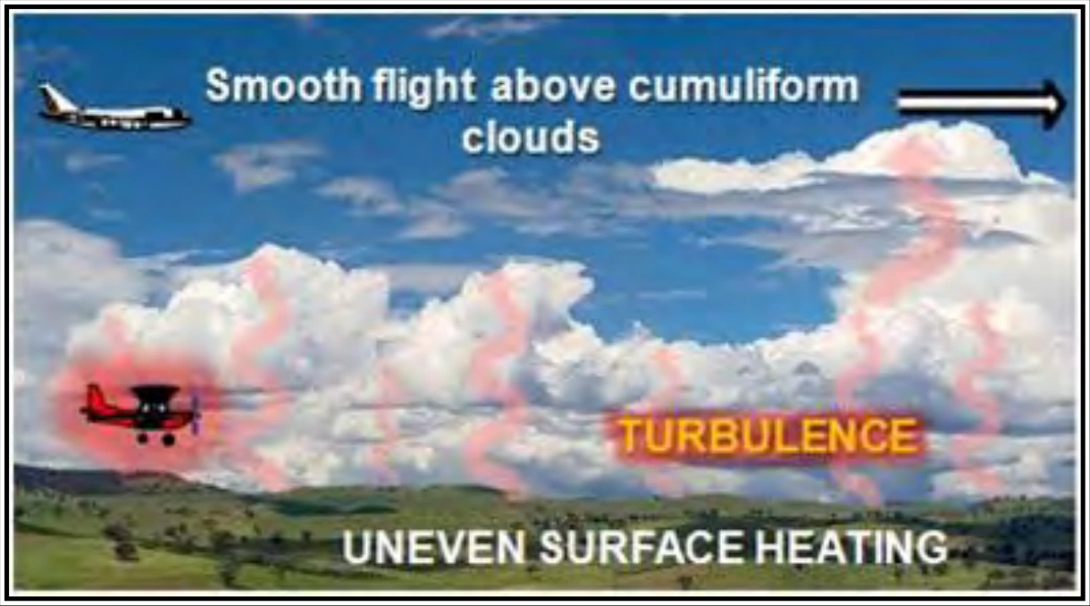
Billowy cumuliform clouds, usually seen over land during sunny afternoons, are signposts in the sky indicating convective turbulence. The cloud top usually marks the approximate upper limit of the convective current. A pilot can expect to encounter turbulence beneath or in the clouds, while above the clouds, air generally is smooth (see Figure 19-1). When convection extends to great heights, it develops larger towering cumulus clouds and cumulonimbus with anvil-like tops. The cumulonimbus gives visual warning of violent convective turbulence.
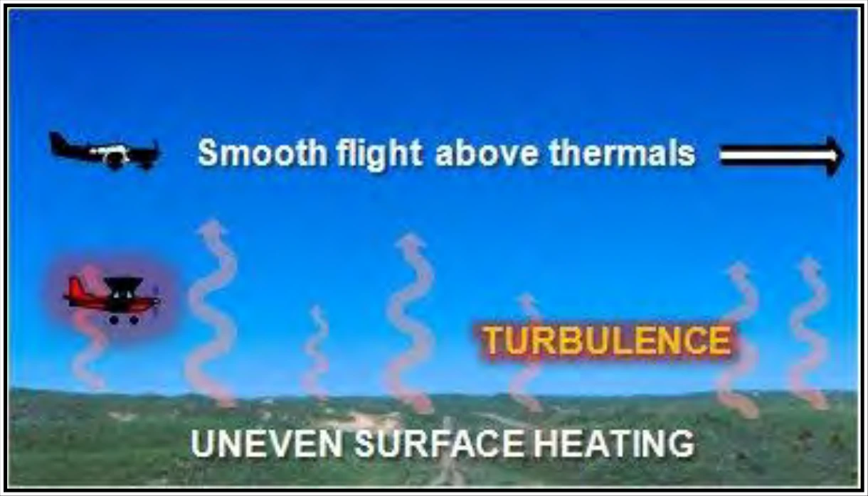
When the air is too dry for cumuliform clouds to form, convective currents can still be active. This is called dry convection, or thermals (see Figure 19-2). A pilot has little or no indication of their presence until encountering the turbulence.
19.2.1.1 Thunderstorms
Turbulence is present in all thunderstorms, and severe or extreme turbulence is common. A severe thunderstorm can destroy an aircraft. Gust loads can be severe enough to stall an aircraft at maneuvering speed or to cause structural damage at cruising speed. The strongest turbulence within the cloud occurs between updrafts and downdrafts.
Outside the cloud, shear turbulence has been encountered several thousand feet above and up to 20 mi laterally from a severe storm. Additionally, clear-air turbulence (CAT) may be encountered 20 or more miles from the anvil cloud edge. These kinds of turbulence are sometimes referred to as Convectively Induced Turbulence (CIT).
It is almost impossible to hold a constant altitude in a thunderstorm and maneuvering to do so greatly increases stress on the aircraft. Stresses are least if the aircraft is held in a constant attitude.
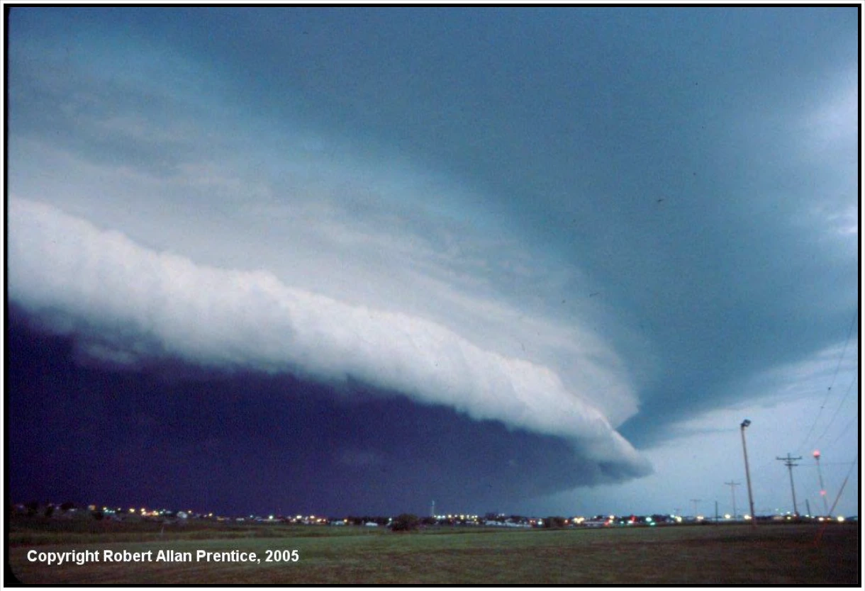
The low-level wind-shear zone between the gust front and surrounding air is very turbulent airspace. Oftentimes, the surface position of the gust front is denoted by a line of dust or debris along the ground or a line of spray along bodies of water. Gust fronts often move far ahead (up to 15 mi) of associated precipitation. The gust front causes a rapid and sometimes drastic change in surface wind ahead of an approaching storm. Often, a “roll cloud” or “shelf cloud” on the leading edge of the storm (see Figure 19-3) marks the top of the extreme turbulence zone, which forms as warm, moist air is lifted by the gust front. Shelf clouds are most common with multicell line thunderstorms.