
Chapter 26
Advisories
26.5.1.4 VAA Graphic Example
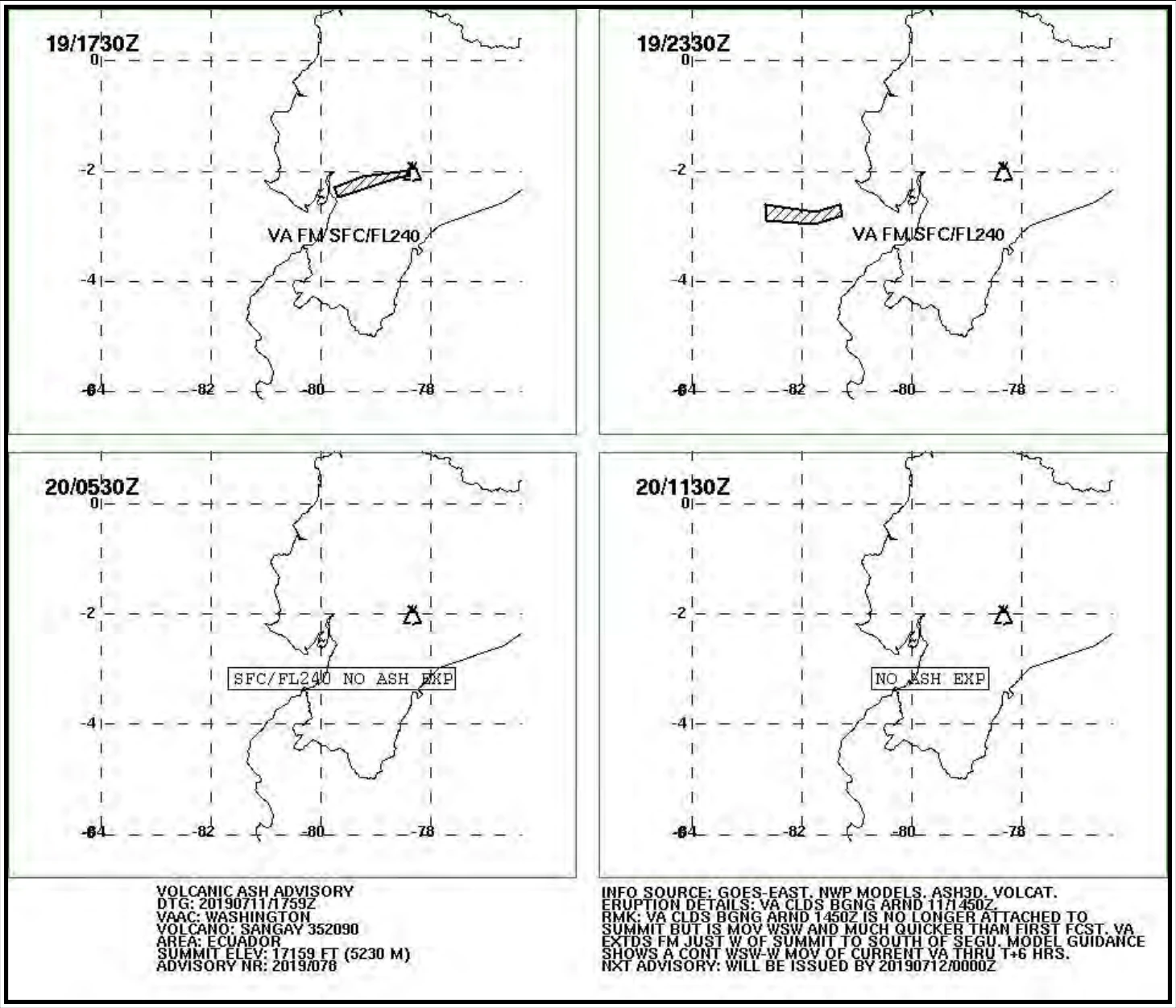
26.6 Aviation Tropical Cyclone Advisory (TCA)
The aviation TCA is intended to provide tropical cyclone forecast guidance, through 24 hours, for international aviation safety and routing purposes. TCAs are issued by the WMO’s TCAC for all ongoing tropical cyclone activity in their respective areas of responsibility. Two of the world’s TCACs are in the United States: the NWS NHC in Miami, FL, and the NWS CPHC in Honolulu, HI.
The NHC is responsible for all ongoing tropical cyclone activity in the Atlantic and eastern Pacific, north of the Equator, while the CPHC is responsible for the central Pacific, north of the Equator. TCAs are available on their respective websites.
26.6.1 TCA Issuance
The NHC and CPHC issue TCAs at 0300, 0900, 1500, and 2100 UTC and are valid from the time of issuance until the next scheduled issuance or update. The forecast position information in the TCA is interpolated from the official forecast data, which is valid at 0000, 0600, 1200, and 1800 UTC.
26.6.2 TCA Content
TCAs list the current tropical cyclone position, motion, and intensity, and 3-, 9-, 15-, 21-, and 27-hour forecast positions and intensities. It is an alphanumeric text product produced by hurricane forecasters and consists of information extracted from the official forecasts.
This forecast is produced from subjective evaluation of current meteorological and oceanographic data as well as output from Numerical Weather Prediction (NWP) models, and is coordinated with affected NWS offices, the NWS national centers, and the DOD.
26.6.3 TCA Example
FKNT22 KNHC 151436
TCANT2
TROPICAL STORM BILL ICAO ADVISORY NUMBER 5
NWS NATIONAL HURRICANE CENTER MIAMI FL
1500 UTC TUE JUN 15 2021
AL022021
TC ADVISORY
DTG: 20210615/1500Z
TCAC: KNHC
TC: BILL
ADVISORY NR: 2021/005
OBS PSN: 15/1500Z N4030 W06200
MOV: NE 33KT
INTST CHANGE: NC
C: 0998HPA
MAX WIND: 050KT
FCST PSN +3 HR: 15/1800Z N4225 W05939
FCST MAX WIND +3 HR: 050KT
FCST PSN +9 HR: 16/0000Z N4425 W05722
FCST MAX WIND +9 HR: 050KT
FCST PSN +15 HR: 16/0600Z N4628 W05507
FCST MAX WIND +15 HR: 045KT
FCST PSN +21 HR: 16/1200Z N//// W/////
FCST MAX WIND +21 HR: ///KT
FCST PSN +27 HR: 16/1800Z N//// W/////
FCST MAX WIND +27 HR: ///KT
RMK: SOME FORECAST INFORMATION IN THIS PRODUCT IS INTERPOLATED FROM OFFICIAL
FORECAST DATA.
NXT MSG: 20210615/2100Z
$$
26.6.4 Additional Tropical Cyclone Information Products
The NHC, CPHC, and select WFOs issue many public tropical storm and hurricane/typhoon information products. Many are in web-based graphical format. For more information on these public forecasts, see the websites of the NHC, CPHC, WFO Guam, and WFOs along the Gulf Coast and the East Coast.
26.7 Space Weather Advisory
ICAO implemented a Space Weather Advisory program in late 2019. Under this program, ICAO designated four global space weather service providers:
- The United States, which is done by the NOAA SWPC.
- The Australia, Canada, France, and Japan (ACFJ) consortium, comprising of space weather agencies from Australia, Canada, France, and Japan.
- The Pan-European Consortium for Aviation Space Weather User Services (PECASUS), comprising of space weather agencies from Finland (lead), Belgium, the United Kingdom, Poland, Germany, Netherlands, Italy, Austria, and Cyprus.
- The China-Russian Federation Consortium (CRC) comprising of space weather agencies from China and the Russian Federation.
26.7.1 Space Weather Advisory Issuance
The SWPC, ACFJ consortium, PECASUS consortium, and CRC consortium serve as four global space weather centers that share the responsibility to issue global Space Weather Advisories, on a rotating basis, when there are impacts to HF COM, SATCOM, satellite-based navigation and surveillance systems (GNSS), or when heightened radiation occurs above FL250.
A Space Weather Advisory is issued whenever space weather conditions exceed predefined ICAO thresholds for both moderate impacts (MOD) and severe impacts (SEV) as given in Table 26-6.