
Chapter 9
Navigation Systems
To fly a route or to execute an approach under IFR, the RNAV equipment installed in the aircraft must be approved for the appropriate IFR operations.
In vertical navigation (VNAV) mode, vertical guidance is provided, as well as horizontal guidance in some installations. A WP is selected at a point where the descent begins, and another WP is selected where the descent ends. The RNAV equipment computes the rate of descent relative to the groundspeed; on some installations, it displays vertical guidance information on the GS indicator. When using this type of equipment during an instrument approach, the pilot must keep in mind that the vertical guidance information provided is not part of the nonprecision approach. Published nonprecision approach altitudes must be observed and complied with, unless otherwise directed by ATC.
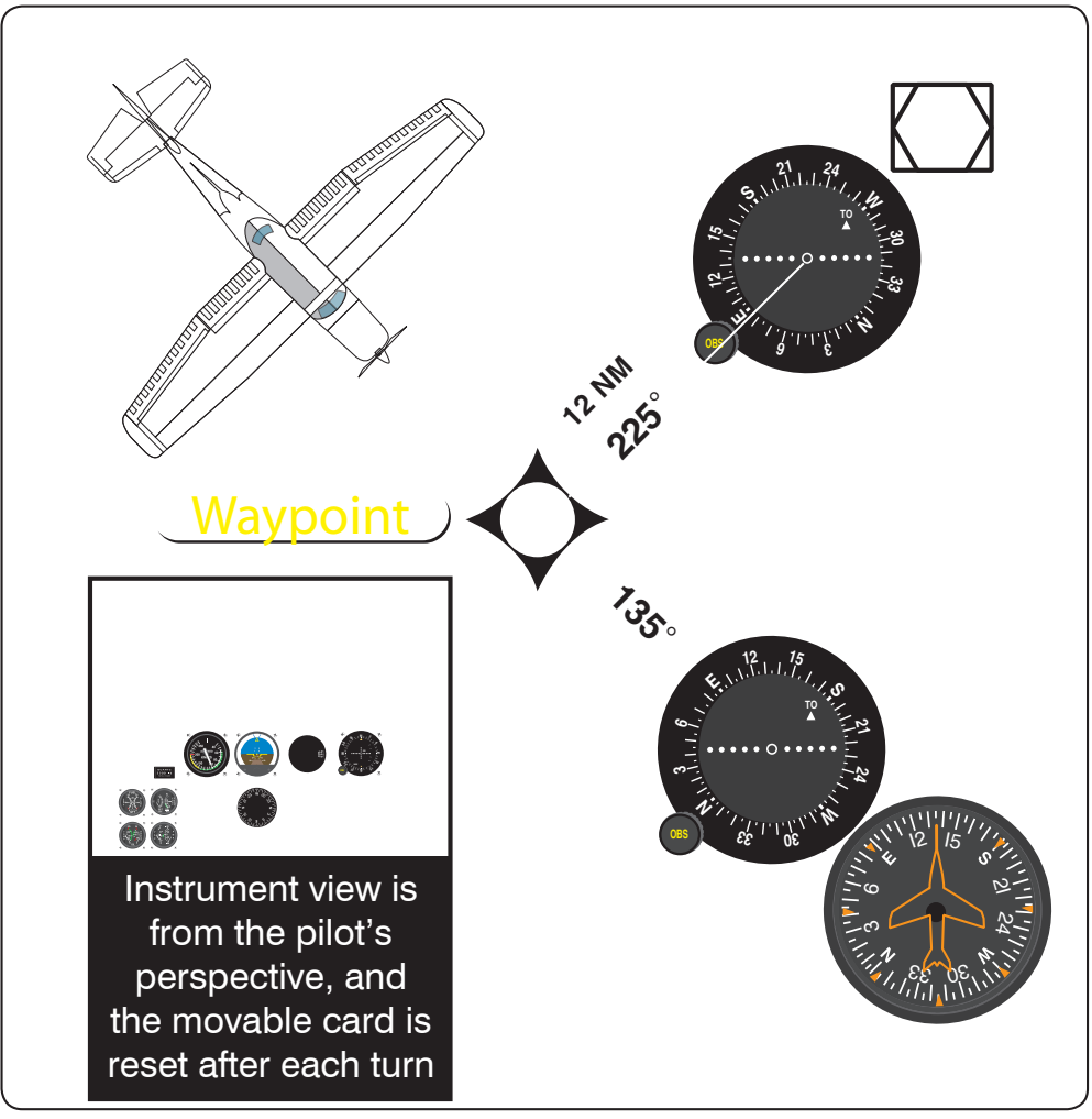
To fly to a WP using RNAV, observe the following procedure [Figure 9-25]:
- Select the VOR/DME frequency.
- Select the RNAV mode.
- Select the radial of the VOR that passes through the WP (225°).
- Select the distance from the DME to the WP (12 NM).
- Check and confirm all inputs, and center the CDI needle with the TO indicator showing.
- Maneuver the aircraft to fly the indicated heading plus or minus wind correction to keep the CDI needle centered.
- The CDI needle indicates distance off course of 1 NM per dot; the DME readout indicates distance in NM from the WP; the groundspeed reads closing speed (knots) to the WP; and the time to station (TTS) reads time to the WP.
VOR/DME RNAV Errors
The limitation of this system is the reception volume. Published approaches have been tested to ensure this is not a problem. Descents/approaches to airports distant from the VOR/DME facility may not be possible because, during the approach, the aircraft may descend below the reception altitude of the facility at that distance.
Advanced Technologies
Global Navigation Satellite System (GNSS)
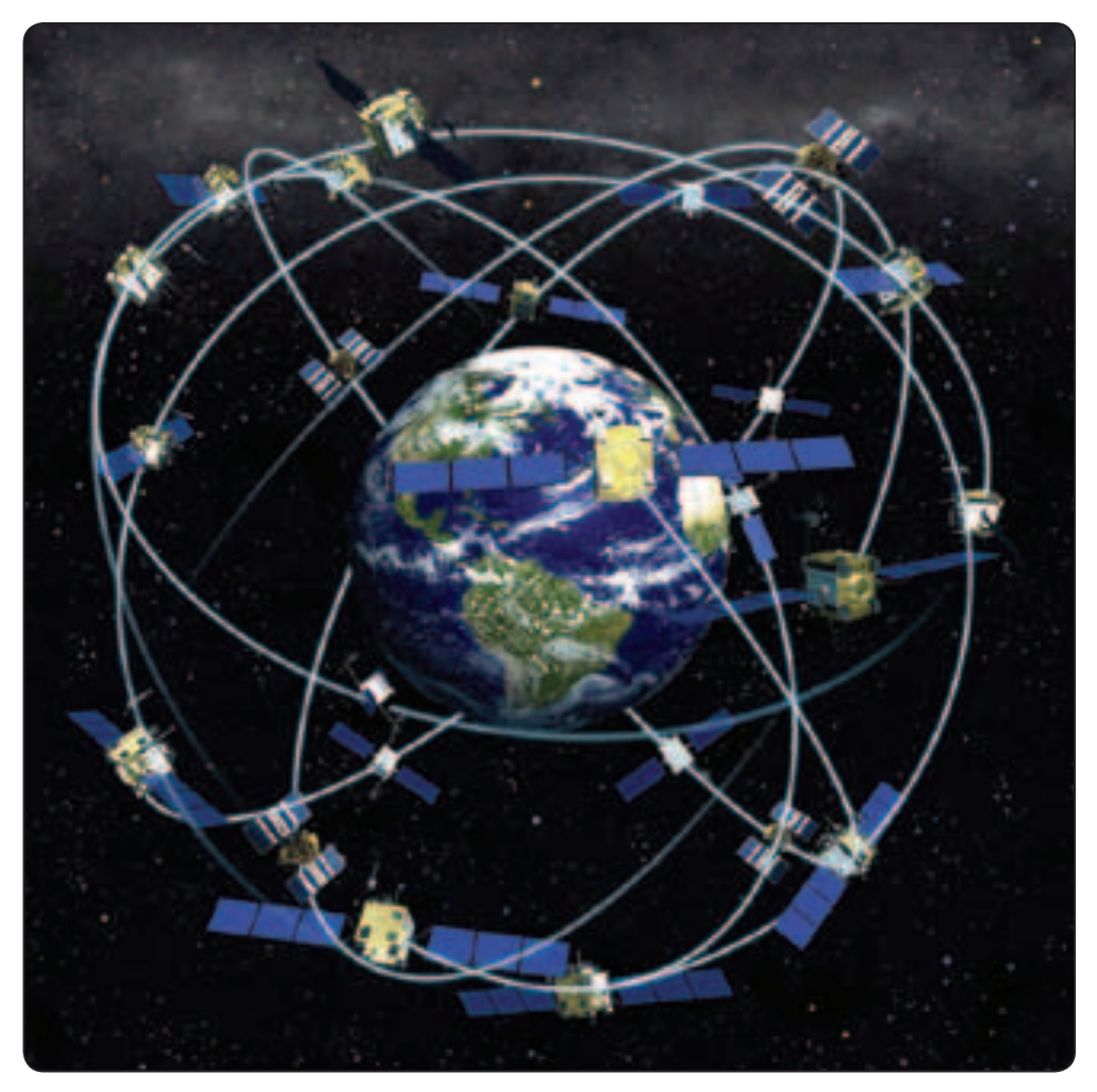
The Global Navigation Satellite System (GNSS) is a constellation of satellites providing a high-frequency signal that contains time and distance that is picked up by a receiver thereby. [Figure 9-26] The receiver that picks up multiple signals from different satellites is able to triangulate its position from these satellites.
Three GNSSs exist today: the GPS, a United States system; the Russian GNSS (GLONASS); and Galileo, a European system.
- GLONASS is a network of 24 satellites that can be picked up by any GLONASS receiver, allowing the user to pinpoint their position.
- Galileo planned to be a network of 30 satellites that continuously transmit high-frequency radio signals containing time and distance data that can be picked up by a Galileo receiver with operational expectancy by 2013.
- The GPS came on line in 1992 with 24 satellites and today utilizes 30 satellites.
Global Positioning System (GPS)
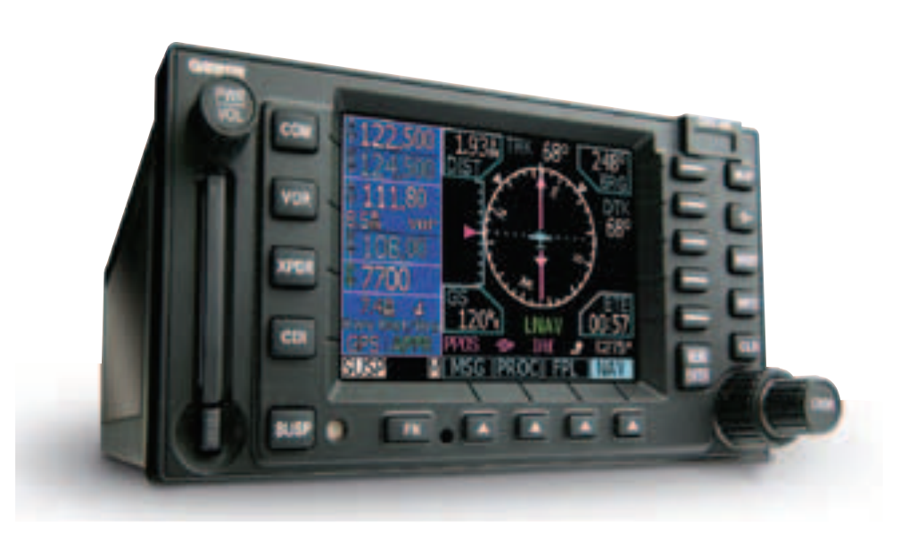
The GPS is a satellite-based radio navigation system that broadcasts a signal that is used by receivers to determine precise position anywhere in the world. The receiver tracks multiple satellites and determines a measurement that is then used to determine the user location. [Figure 9-27]
The Department of Defense (DOD) developed and deployed GPS as a space-based positioning, velocity, and time system. The DOD is responsible for operation of the GPS satellite constellation, and constantly monitors the satellites to ensure proper operation. The GPS system permits Earth-centered coordinates to be determined and provides aircraft position referenced to the DOD World Geodetic System of 1984 (WGS-84). Satellite navigation systems are unaffected by weather and provide global navigation coverage that fully meets the civil requirements for use as the primary means of navigation in oceanic airspace and certain remote areas. Properly certified GPS equipment may be used as a supplemental means of IFR navigation for domestic en route, terminal operations and certain IAPs. Navigational values, such as distance and bearing to a WP and groundspeed, are computed from the aircraft’s current position (latitude and longitude) and the location of the next WP. Course guidance is provided as a linear deviation from the desired track of a Great Circle route between defined WPs.
GPS may not be approved for IFR use in other countries. Prior to its use, pilots should ensure that GPS is authorized by the appropriate countries.