
Chapter 5
Improvement Plans
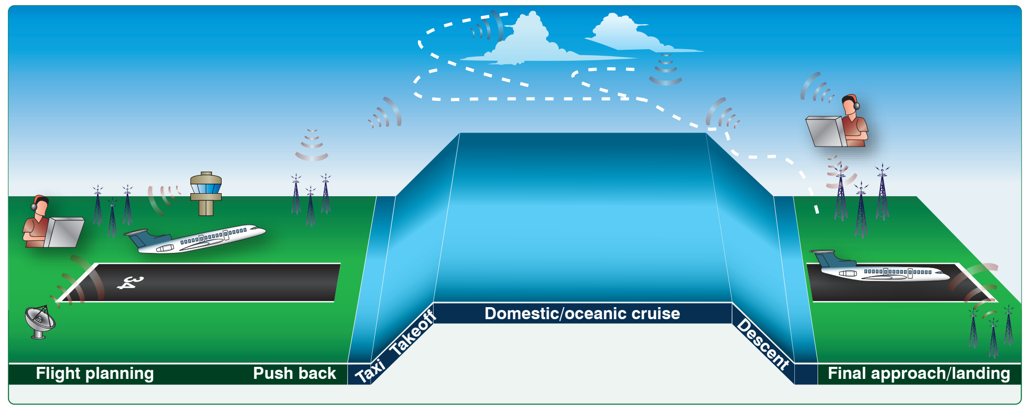
more safety benefits such as improved situational awareness (SA), near real-time weather information, and additional voice communications.
- ADS-B services have been deployed to all 24 modernized enroute ARTCCs and the largest terminal radar approach control facilities in the NAS. In 2020, ADS-B will be mandatory for all aircraft in almost all NAS controlled airspace. [Figure 5-8]
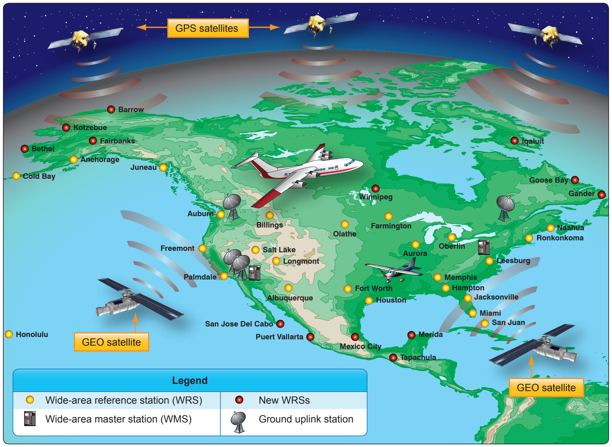
- Satellite-based technologies, including the Wide Area Augmentation System (WAAS), are improving access to runways at both large and small airports. [Figure 5-9] Directions and maps have been published for more than 500 precision-like approaches enabled by WAAS. Localizer performance with vertical guidance (LPV) procedures improves access to airports in lower visibility conditions and where obstacles are present. These procedures are particularly valuable for smaller airports used by general aviation. There are now oer 2,300 LPV procedures available at runways where no instrument landing system (ILS) is present.
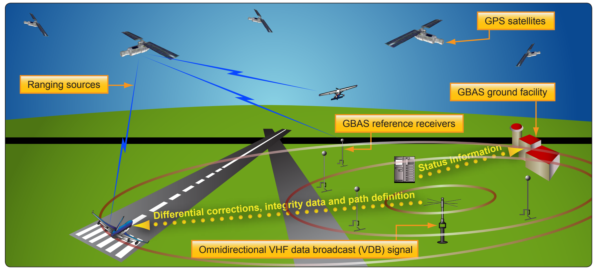
- The Ground-Based Augmentation System (GBAS) has been approved for Category I operations and the first satellite-based system has been approved for this category of precision approach which enables instrument-based operations down to 200 feet above the surface even during reduced visibility. [Figure 5-10] GBAS was installed at Houston, Texas and Newark, New Jersey airport in 2009.
- Multilateration, a ground-based surveillance technology, is being implemented to help improve runway access. The FAA installed and is now using wide area multilateration (WAM) systems to control air traffic in Juneau, Alaska, and at four airports in Colorado. This allows air traffic to be safely separated by five miles whereas before each aircraft had to clear the airspace around the airport before the next could enter.
- New runways at Chicago O’Hare, Washington Dulles, and Seattle-Tacoma Airports opened in November of 2008, which are now beginning to have a reduction in delays.
Benefits of NextGen
The implementation of NextGen will allow pilots and dispatchers to select their own direct flightpaths, rather than follow the existing Victor, Jet, and LF/MF airways. Each aircraft will transmit and receive precise information about the time at which it and others will cross key points along their paths. Pilots and air traffic managers on the ground will have the same precise information transmitted via data communications.
Major demand and capacity imbalances will be worked collaboratively between FAA air traffic managers and flight operations. The increased scope, volume, and widespread distribution of information by SWIM will improve decision- making and let more civil aviation authorities participate. The impact of weather on flight operations will be reduced through the use of improved information sharing, new technology to sense and mitigate the impacts of the weather, and to improve weather forecasts and decision-making. Better forecasts, coupled with greater automation, will minimize airspace limitations and traffic restrictions.
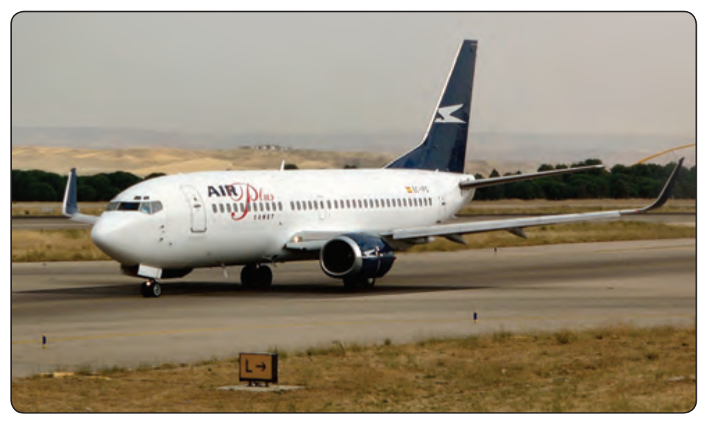
The new procedures of NextGen will improve airport surface movements, reduce spacing and separation requirements, and better manage the overall flows into and out of busy airspace, as well as provide maximum use of busy airports. [Figure 5-11] Targeting NextGen at the whole of the NAS, rather than just the busiest airports, will uncover untapped capacity across the whole system. During busy traffic periods, NextGen will rely on aircraft to fly precise routes into and out of many airports to increase throughput. For more information on NextGen, visit www. ([source link](http://www.faa.gov/nextgen)) [faa.gov/nextgen](http://www.faa.gov/nextgen).
Head-Up Displays (HUD)
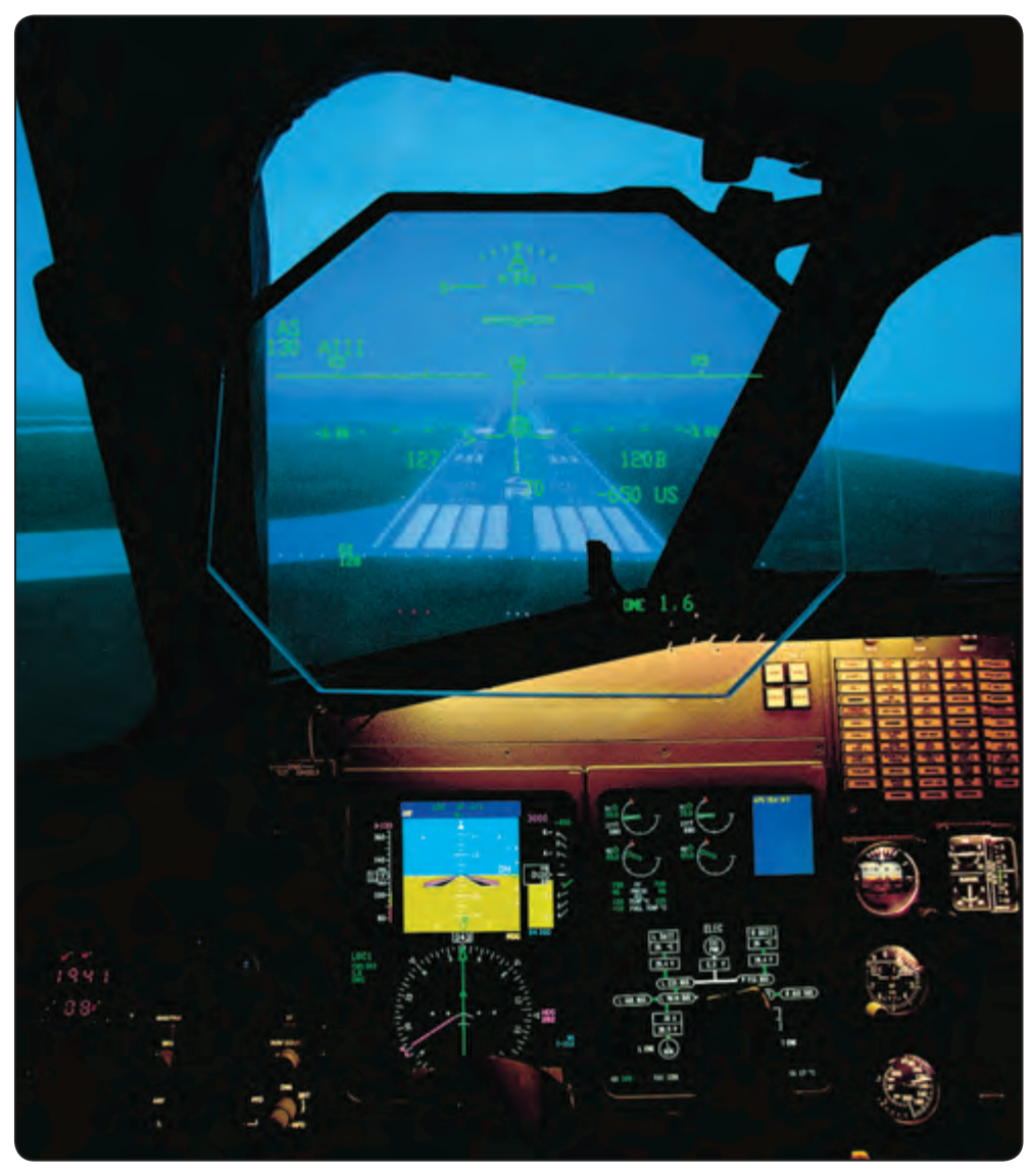
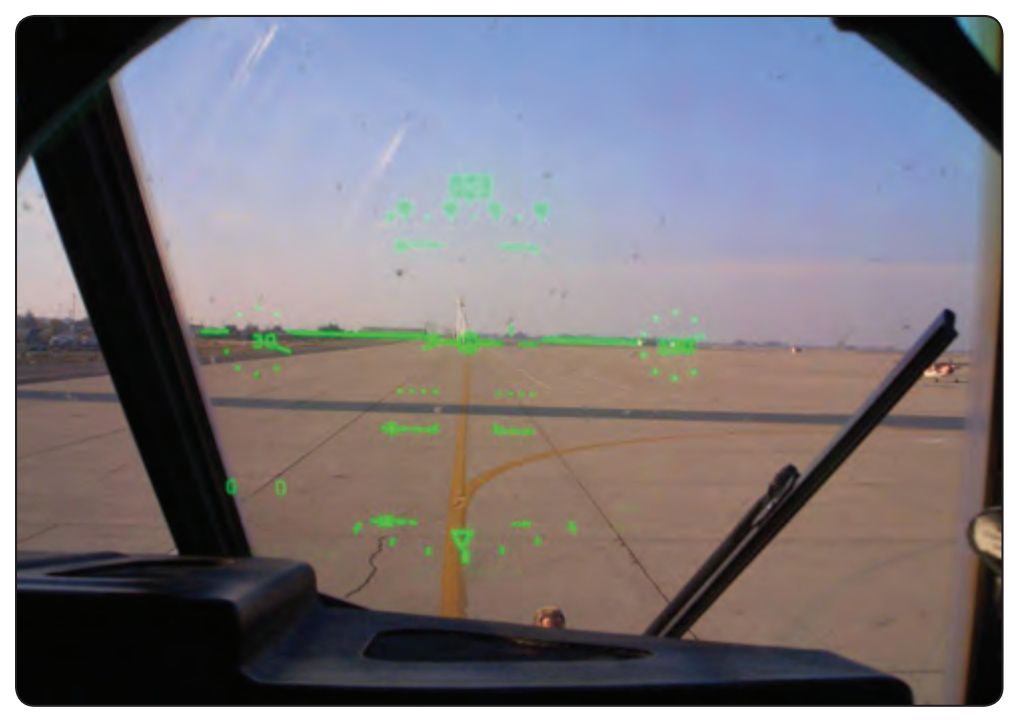
As aircraft became more sophisticated and electronic instrument landing systems (ILS) were developed in the 1930s and 1940s, it was necessary while landing in poor weather for one pilot to monitor the instruments to keep the aircraft aligned with radio beams while the second pilot divided time between monitoring the instruments and the outside environment. The pilot monitoring reported the runway environment in sight and the flying pilot completed the approach visually. This is still the standard practice used for passenger carrying aircraft in commercial service while making ILS landings. As single-piloted aircraft became more complex, it became very difficult for pilots to focus on flying the aircraft while also monitoring a large number of navigation, flight, and systems instruments. To overcome this problem, the head-up display (HUD) was developed. By showing airspeed, altitude, heading, and aircraft attitude on the HUD glass, pilots were able to keep their eyes outside of the flight deck rather than have to continuously scan from outside to inside to view the flight instruments. [Figure 5-12] Collimators make the image on the glass appear to be far out in front of the aircraft so that the pilot need not change eye focus to view the relatively nearby HUD. Today’s head-up guidance systems (HGS) use holographic displays. [Figure 5-13] Everything from weapons status to approach information can be shown on current military and civilian HGS displays.
Synthetic and Enhanced Vision Systems
Synthetic Vision System (SVS)
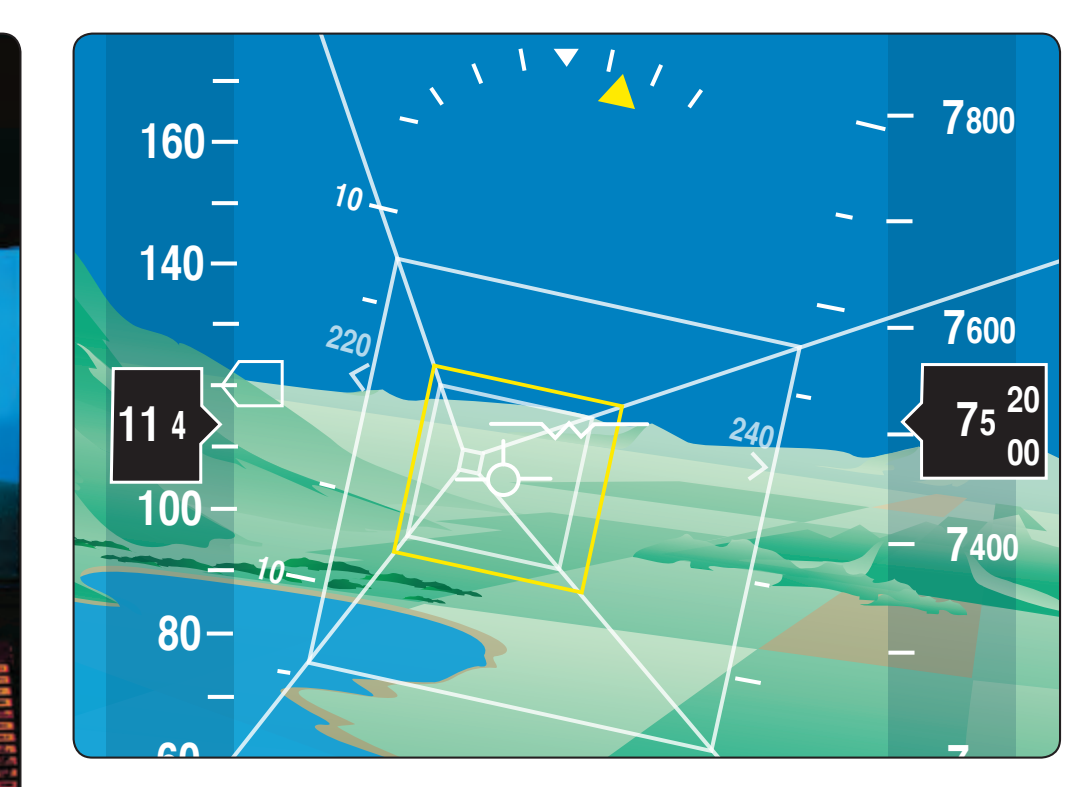
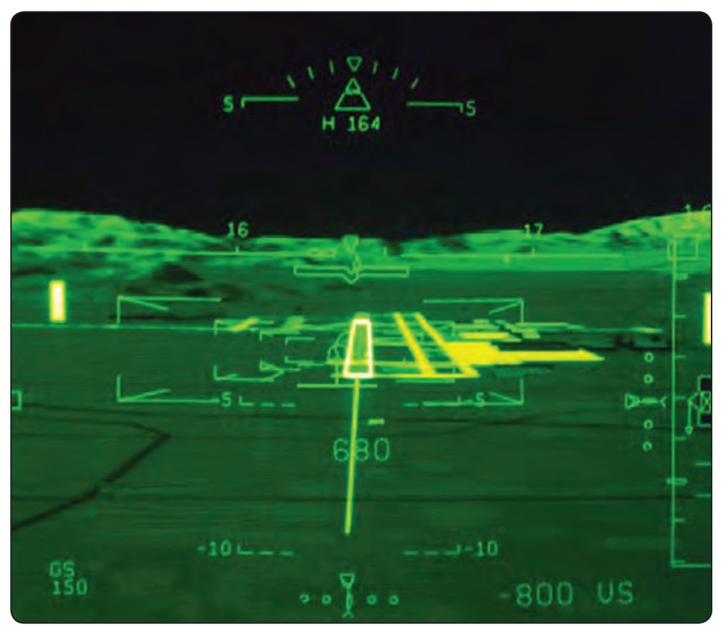
A synthetic vision system (SVS) is an electronic means to display a synthetic vision image of the external scene topography to the flight crew. [Figure 5-14] It is not a real-time image like that produced by an enhanced flight vision system (EFVS). Unlike EFVS, SVS requires a terrain and obstacle database, a precise navigation solution, and a display. The terrain image is based on the use of data from a digital elevation model (DEM) that is stored within the SVS. With SVS, the synthetic terrain/vision image is intended to enhance pilot awareness of spatial position relative to important features in all visibility conditions. This is particularly useful during critical phases of flight, such as takeoff, approach, and landing where important features such as terrain, obstacles, runways, and landmarks may be depicted on the SVS display. [Figure 5-15] During approach operations, the obvious advantages of SVS are that the digital terrain image remains on the pilot’s display regardless of how poor the visibility is outside. An SVS image can be displayed on either a head-down display or head-up display (HUD). Development efforts are currently underway that would combine SVS with a real-time sensor image produced by an EFVS. These systems will be known as Combined Vision Systems (CVS).