IFR low- and high-altitude enroute chart legends, symbols, examples, and procedures.
MOCA of 13300’
MCA for aircraft traveling West along V520 to cross JAC at 15200’
MCA for aircraft traveling West along V330 to cross JAC at 13400’
MTA for aircraft crossing over and turning at JAC:
Aircraft traveling NE on V465 and turning to V330 on a W heading or turning to V520 on a W heading must turn at altitude of 16000’ or higher
Aircraft traveling E on V520 and turning to V330 on a W heading must turn at altitude of 14200’
Aircraft traveling E on V330 and turning to V520 on a W heading must turn at altitude of 16000’ or higher
Aircraft traveling NW on V328 and turning to V465 on a SW heading must turn at altitude of 15100’ or higher.
AIRSPACE INFORMATION (Continued) Enroute Chart Examples Low Enroute Chart (Continued) Reference Number 5 6 Description MEA VHF and RNAV Example MEA for aircraft utilizing VHF NAVAID of 15000’ MEA for aircraft utilizing RNAV of 13300’ MOCA of 13300’ MCA and MTA Example at a NAVAID MCA for aircraft traveling West along V520 to cross JAC at 15200’ MCA for aircraft traveling West along V330 to cross JAC at 13400’ MTA for aircraft crossing over and turning at JAC: Aircraft traveling NE on V465 and turning to V330 on a W heading or turning to V520 on a W heading must turn at altitude of 16000’ or higher Aircraft traveling E on V520 and turning to V330 on a W heading must turn at altitude of 14200’ Aircraft traveling E on V330 and turning to V520 on a W heading must turn at altitude of 16000’ or higher Aircraft traveling NW on V328 and turning to V465 on a SW heading must turn at altitude of 15100’ or higher.
Source page 87
Airspace Information (Continued)
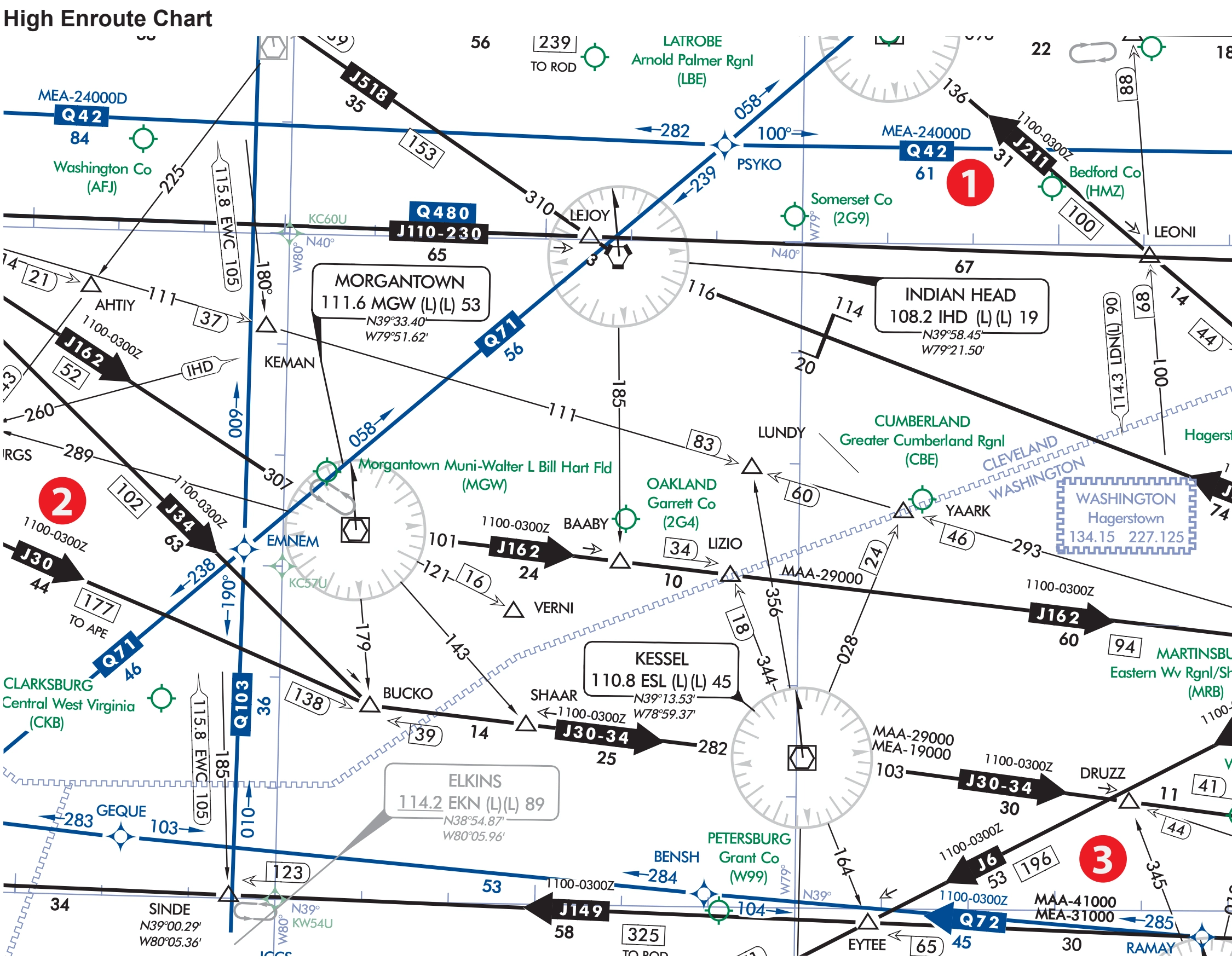
High Enroute Chart example with numbered references — source page 87.
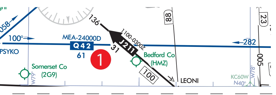
High RNAV route with MEA for DME/DME/IRU RNAV aircraft — source page 87.
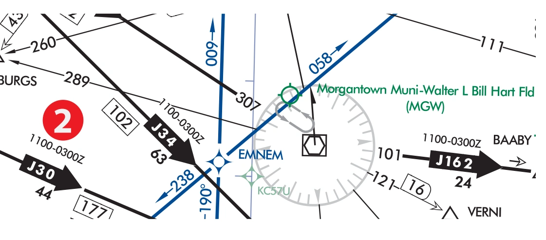
Preferred directional jet route with time restrictions — source page 87.
Airspace Information (Continued) Enroute Chart Examples High Enroute Chart 2 3 1 Reference Number 1 2 Description High RNAV Route with MEA for DME/DME/IRU RNAV Aircraft MEA of 24,000’ Preferred Directional Jet Route with Time Restrictions Jet Route 34 available between 1100 - 0300Z
Source page 88
AIRSPACE INFORMATION (Continued)
Enroute Chart Examples
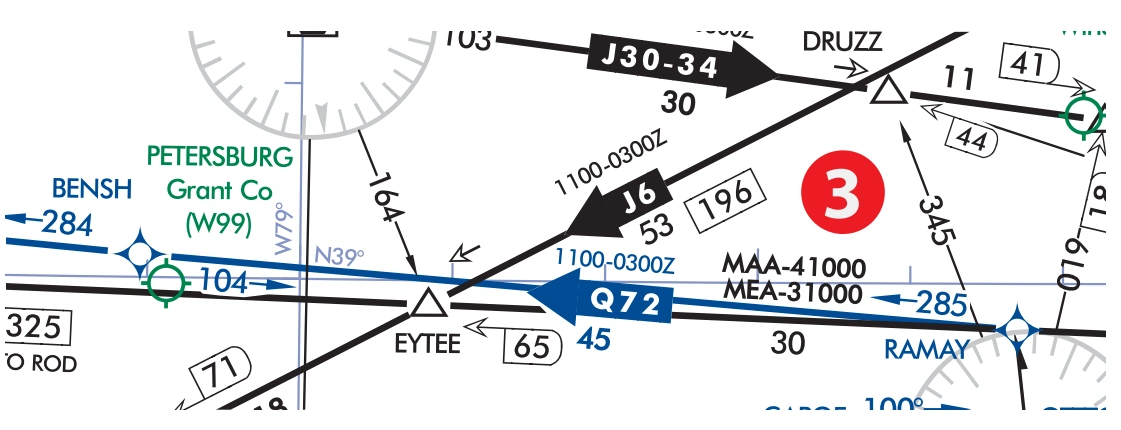
Preferred directional jet route with time restrictions, MAA, and MEA — source page 88.
Preferred Directional Jet Route with Time Restrictions, MAA and MEA
Cookie Preferences
We use cookies to operate this website, improve performance, understand site traffic, and personalize your experience. Essential cookies are always active because they are required for the website to function.
Required for basic site functionality and security.
Help us understand how visitors use the website so we can improve it.
May be used for advertising, remarketing, or social media features.
You can update your choices anytime using Cookie Settings. View Privacy Policy