Aviation Training Experts™

other

Aeronautical Chart Users’ Guide

FAA Chart Users’ Guide Version 9 July 2026

IFR Enroute Low/High Altitude Symbols

IFR low- and high-altitude enroute chart legends, symbols, examples, and procedures.

Jet Route 149 available between 1100 - 0300Z
MAA - 41,000’
MEA - 31,000’

AIRSPACE BOUNDARIES

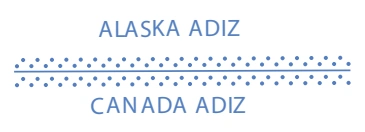
Air Defense

FAA aeronautical chart visual associated with “Identification Zone (ADIZ)” (source page 88).
Identification Zone (ADIZ) — source page 88.

Identification Zone (ADIZ)

FAA aeronautical chart visual associated with “Identification Zone (ADIZ)” (source page 88).
Identification Zone (ADIZ) — source page 88.
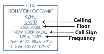
FAA aeronautical chart visual associated with “ATS identification data — CTA Houston Oceanic KZHU (ceiling/floor/call sign/frequency)” (source page 88).
ATS identification data — CTA Houston Oceanic KZHU (ceiling/floor/call sign/frequency) — source page 88.
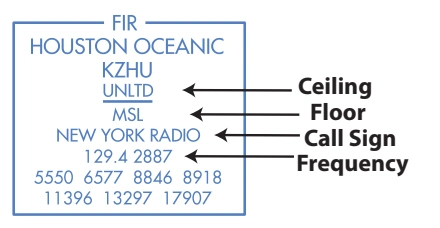
FAA aeronautical chart visual associated with “ATS identification data — FIR Houston Oceanic KZHU” (source page 88).
ATS identification data — FIR Houston Oceanic KZHU — source page 88.

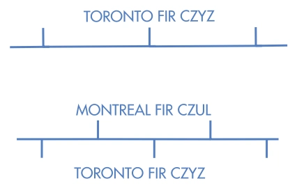
Flight Information Regions (FIR)

FAA aeronautical chart visual associated with “Upper Information Regions” (source page 88).
Upper Information Regions — source page 88.

Upper Information Regions

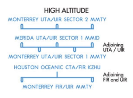
FAA aeronautical chart visual associated with “High-altitude adjoining UTA/UIR and FIR/UIR boundaries” (source page 88).
High-altitude adjoining UTA/UIR and FIR/UIR boundaries — source page 88.

(UIR)

Upper Control Areas (UTA)

Air Route Traffic Control
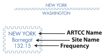
FAA aeronautical chart visual associated with “ARTCC boundary/remote-site box — New York Center, Barnegat, 132.15” (source page 88).
ARTCC boundary/remote-site box — New York Center, Barnegat, 132.15 — source page 88.

Center (ARTCC)

ARTCC Remoted Sites with