User-friendly explanations of instrument approach charts, planviews, profiles, minimums, airport diagrams, departures, arrivals, and visual procedures.
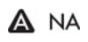
Non-standard IFR alternate minimums symbol — A — source page 103.
The IAP may not be used as an alternate due to unmonitored facility, absence of weather reporting service, or lack of adequate navigation coverage. IAPs designated with this symbol are not listed in the IFR Alternate Minimums section of the TPP.
IAP may not be used as an alternate — A NA notes symbol — source page 103.
WAAS (Wide Area Augmentation System)
WAAS (Wide Area Augmentation System) — source page 103.
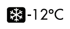
Cold Temperature Airport
Cold Temperature Airport symbol — snowflake — source page 103.
The negative within a black square box symbol shown in the Notes section below any “A” or “T” Symbol indicates that outages of the WAAS (Wide Area Augmentation System) vertical guidance may occur daily at this location due to initial system limitations. WAAS NOTAMs for vertical outages are not provided for this approach. Use LNAV minima for flight planning at these locations, whether as a destination or alternate. For flight operations at these locations, when the WAAS avionics indicate that LNAV/VNAV or LPV service is available, then vertical guidance may be used to complete the approach using the displayed level of service. Should an outage occur during the procedure, reversion to LNAV minima may be required.
Negative W in a black square — WAAS vertical-guidance outage limitation symbol — source page 103.
Notes Box Procedure Equipment Requirements Notes Box Performance-Based Navigation (PBN) Requirements and ground-based Equipment Requirements are displayed in separate, standardized notes boxes. For procedures with PBN elements, the PBN box contains the procedure’s navigation specification(s). If required, specific sensors or infrastructure needed for the navigation solution, additional or advanced functional requirements, and the minimum Required Navigation Performance (RNP) value and any amplifying remarks will also be included. Items listed in this PBN box are REQUIRED. The separate Equipment Requirements Box will list ground-based equipment requirements. On procedures with both PBN elements and ground-based equipment requirements, the PBN requirements box is listed first. Remote Altimeter Airport Notes Approach minimums are based on the local altimeter setting for that airport unless annotated otherwise. When more than one altimeter source is authorized, and the minima are different, they will be shown by separate lines in the approach minima box or as a note in the briefing strip; e.g., use MHK altimeter setting; when not available use SLN altimeter setting and increase all MDAs 40 feet. The altimeter source location is referenced by the FAA airport identifier. An airport outside the contiguous U.S. will use both the FAA and ICAO identifiers. Until all charts reference the airport identifier, the notes may contain altimeter sources referenced by city name, city and state, or airport name. Notes Symbols Several different symbols may appear within the Notes Box: An entry is published in the Takeoff Minimums, (Obstacle) Departure Procedures, and Diverse Vector Area (Radar Vectors) section of the TPP. Non-standard IFR alternate minimums exist. Refer to IFR Alternate Airport Minimums section of the TPP. The IAP may not be used as an alternate due to unmonitored facility, absence of weather reporting service, or lack of adequate navigation coverage. IAPs designated with this symbol are not listed in the IFR Alternate Minimums section of the TPP. WAAS (Wide Area Augmentation System) Cold Temperature Airport The negative within a black square box symbol shown in the Notes section below any “A” or “T” Symbol indicates that outages of the WAAS (Wide Area Augmentation System) vertical guidance may occur daily at this location due to initial system limitations. WAAS NOTAMs for vertical outages are not provided for this approach. Use LNAV minima for flight planning at these locations, whether as a destination or alternate. For flight operations at these locations, when the WAAS avionics indicate that LNAV/VNAV or LPV service is available, then vertical guidance may be used to complete the approach using the displayed level of service. Should an outage occur during the procedure, reversion to LNAV minima may be required.
Source page 104
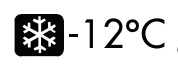
When appears in the Notes section below all other symbols it indicates a cold temperature altitude correction is required at that airport when the reported temperature is at or below the published temperature. Advise ATC with altitude correction. Advising ATC with altitude corrections is not required in the final segment. See Aeronautical Information Manual (AIM), Chapter 7, for guidance and additional information. For a complete list of cold temperature airports, see https://aeronav.faa.gov/d-tpp/Cold_Temp_Airports.pdf.
Cold Temperature Airport symbol — −12 °C — source page 104.
When “ASR”, “PAR” or “ASR/PAR” appear in the Note section immediately below the “T” and “A” symbols it indicates there are published Radar Instrument Approach Minimums. Where radar is approved for approach control service, it is used not only for radar approaches (Airport Surveillance Radar [ASR] and Precision Approach Radar [PAR]) but is also used to provide vectors in conjunction with published non-radar approaches based on radio NAVAIDs (ILS, VOR, NDB, TACAN). Radar vectors can provide course guidance and expedite traffic to the final approach course of any established IAP or to the traffic pattern for a visual approach.
The communications briefing strip contains communication information when available, in separate boxes, listed from left to right in the order that they would be used during arrival with the tower frequency box bolded:
Communications strip — ATIS, APP CON, TOWER, GND CON, CLNC DEL, UNICOM — source page 104.
ATIS, D-ATIS, AFIS (AK Only) or ASOS/AWOS frequencies (when available, ATIS or AFIS will be the only local weather frequency/s published)
The primary Approach Control (APP CON) name and frequencies; when the primary approach service is provided by other than Approach Control, e.g. FSS (Radio), Tower, Center, the appropriate air traffic facility call name is provided
The Control Tower (TOWER) name and frequencies, to include Precision Radar Monitoring (PRM) and frequency
Ground Control (GND CON) frequencies
Clearance Delivery (CLNC DEL) frequencies; where a Control Tower does not exist or is part-time, a remoted CLNC DEL may be listed.
Ground Communications Outlet (GCO) frequency
Common Traffic Advisory Frequency (CTAF), shown in parentheses when shares a frequency, e.g. UNICOM 122.8 (CTAF)
UNICOM or AUNICOM frequency (part-time and non-towered airports only)
Controller Pilot Data Link Communication (CPDLC) (part-time and non-towered airports only)
Note: Part-time operations will be annotated with a star. Check Chart Supplement for times of operation.
Note: Departure ATIS, CLNC DEL, and CPDLC will not be charted on the IAP at locations where the information is shown on the corresponding Airport Diagram.
Cookie Preferences
We use cookies to operate this website, improve performance, understand site traffic, and personalize your experience. Essential cookies are always active because they are required for the website to function.
Required for basic site functionality and security.
Help us understand how visitors use the website so we can improve it.
May be used for advertising, remarketing, or social media features.
You can update your choices anytime using Cookie Settings. View Privacy Policy