User-friendly explanations of instrument approach charts, planviews, profiles, minimums, airport diagrams, departures, arrivals, and visual procedures.
Source page 108
NAVAIDs
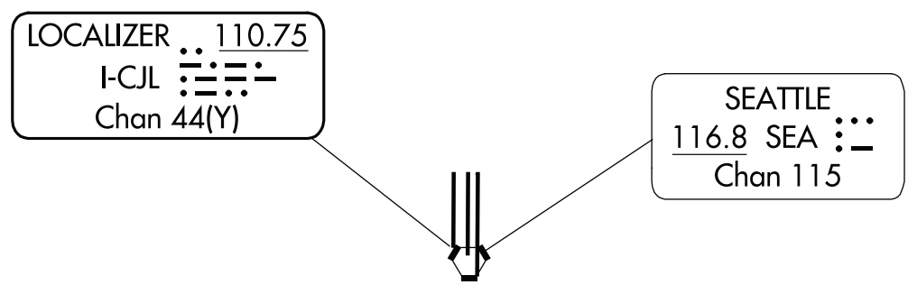
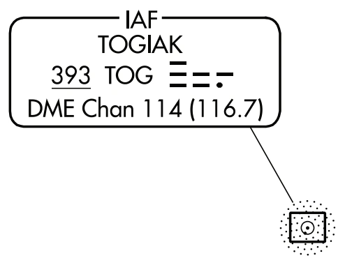
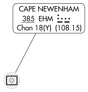
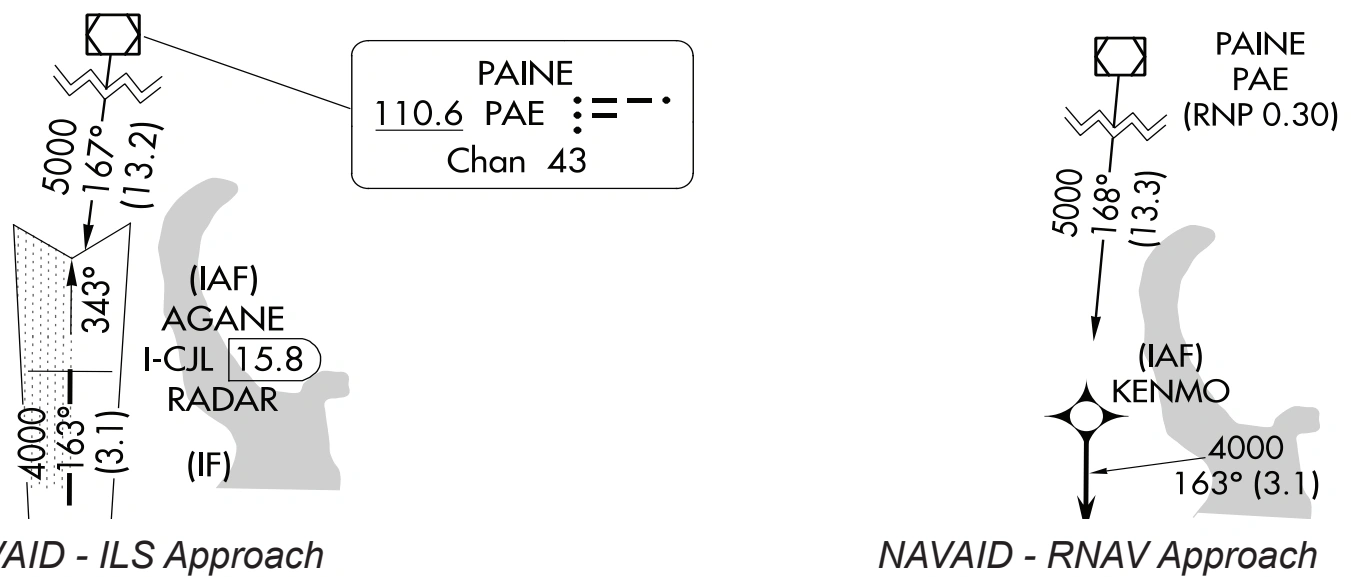
NAVAIDs used on ground based charts will show the appropriate symbol accompanied by a data box that contains the facility name, frequency, identifier and Morse code. A NAVAID box with a heavy line indicates the primary NAVAID used for the approach.
NAVAIDs used on GPS based charts show the appropriate symbol identified with the name and identifier.
Primary NAVAID LOC and secondary NAVAID VORTAC — source page 108.
Primary NAVAID NDB/DME — Togiak (TOG) — source page 108.
Secondary NAVAID — NDB/DME Cape Newenham EHM 385, Ch18(Y)/108.15 — source page 108.
NAVAID comparison — ILS and RNAV approaches — source page 108.
Area Navigation (RNAV) Waypoints
RNAV waypoint — ELIZE — source page 108.
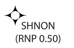
RNAV waypoint with RNP note — SHNON (RNP 0.50) — source page 108.
NAVAIDs NAVAIDs used on ground based charts will show the appropriate symbol accompanied by a data box that contains the facility name, frequency, identifier and Morse code. A NAVAID box with a heavy line indicates the primary NAVAID used for the approach. NAVAIDs used on GPS based charts show the appropriate symbol identified with the name and identifier. Primary NAVAID - LOC Secondary NAVAID - VORTAC Primary NAVAID - NDB/DME Secondary NAVAID - NDB/DME NAVAID - ILS Approach NAVAID - RNAV Approach Area Navigation (RNAV) Waypoints Waypoints are shown with the waypoint symbol accompanied by the five letter identifier. If an RNAV waypoint is collocated with an intersection, DME fix, or NAVAID, the appropriate Intersection, DME fix, or NAVAID symbol will be charted. ELIZE On RNAV (RNP) charts, any requirement/capability notes are depicted below the fix/waypoint/NAVAID name. When the required RNP lateral accuracy value for any approach segment other than final approach (e.g. feeder, initial and/or intermediate or missed) are less than standard (RNP 2.00 for feeder, RNP 1.00 for initial and/or intermediate and missed), a note stating the required RNP value may be placed adjacent to the applicable fix at the beginning of the Feeder Route (or annotated in the PBN box). If there is more than one lateral accuracy value within these portions of the procedure, the lowest value is annotated. These notes will take the form “RNP 0.XX, or Min RNP 0.XX” and will be located in close proximity to the relevant fix name (or be identified in the PBN Box). SHNON (RNP 0.50)
Source page 109
Localizer Depiction
The localizer is depicted in the Planview using the following symbol. The size of the charted localizer symbol does not serve as an indication of the service volume.
LOC/LDA course — right shading front course, left shading back course — source page 109.
Restrictive Airspeed
Restrictive airspeeds are shown paired with their respective fix/facility.
Type | Description | Example
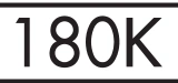
Recommended Speed | Recommended speed is depicted with no lines above or below it |
Minimum Speed | Minimum speed is depicted as a number with a line below it |
Maximum Speed | Maximum speed is depicted as a number with a line above it |
Mandatory Speed | Mandatory speed is depicted as a number with a line above and below it |
Recommended speed — 180K — source page 109.
Cookie Preferences
We use cookies to operate this website, improve performance, understand site traffic, and personalize your experience. Essential cookies are always active because they are required for the website to function.
Required for basic site functionality and security.
Help us understand how visitors use the website so we can improve it.
May be used for advertising, remarketing, or social media features.
You can update your choices anytime using Cookie Settings. View Privacy Policy