
Chapter 22
Thunderstorms
22.1 Introduction
A thunderstorm is a local storm, invariably produced by a cumulonimbus (CB) cloud, and always accompanied by lightning and thunder, usually with strong gusts of wind, heavy rain, and sometimes hail. There are as many as 40,000 thunderstorm occurrences each day worldwide, and the United States certainly experiences its share.
Thunderstorms are barriers to air traffic because they are usually too tall to fly over, too dangerous to fly through or under, and can be difficult to circumnavigate. Weather recognizable as a thunderstorm should be considered hazardous, as penetration of any thunderstorm can lead to an aircraft accident and fatalities to those on board.
22.2 Necessary Ingredients for Thunderstorm Cell Formation
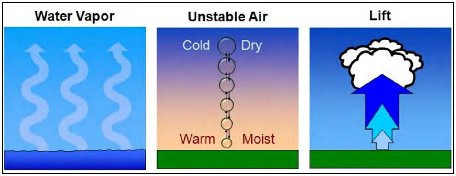
Thunderstorm cell formation needs three ingredients: sufficient water vapor, unstable air, and a lifting mechanism (see Figure 22-1). Sufficient water vapor (commonly measured using dewpoint) must be present to produce unstable air. Virtually all showers and thunderstorms form in an air mass that is classified as conditionally unstable. A conditionally unstable air mass needs a lifting mechanism strong enough to release the instability. Lifting mechanisms include converging winds around surface lows and troughs, fronts, upslope flow, drylines, outflow boundaries generated by prior storms, and local winds, such as sea breeze, lake breeze, land breeze, and valley breeze circulations.
22.3 Thunderstorm Cell Life Cycle
A thunderstorm cell is the convective cell of a cumulonimbus cloud having lightning and thunder. It undergoes three distinct stages during its life cycle (see Figure 22-2): towering cumulus, mature, and dissipating. The total life cycle is typically about 30 minutes.
The distinguishing feature of the towering cumulus stage is a strong convective updraft. The updraft is a bubble of warm, rising air concentrated near the top of the cloud, which leaves a cloudy trail in its wake. Updraft speeds can exceed 3,000 fpm.
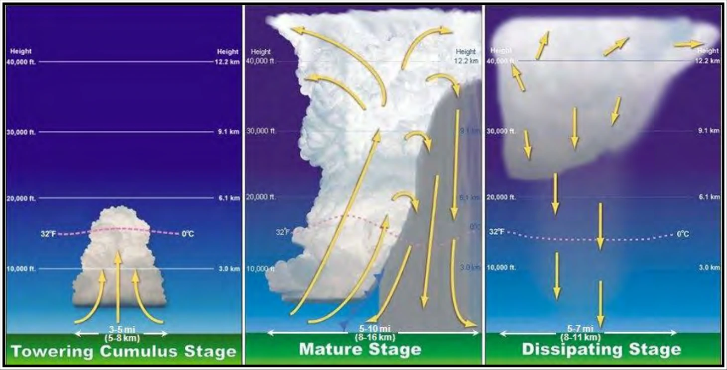
The cell transitions to the mature stage when precipitation reaches the surface. Precipitation descends through the cloud and drags the adjacent air downward, creating a strong downdraft alongside the updraft. The downdraft spreads out along the surface, well in advance of the parent thunderstorm cell, as a mass of cool, gusty air. The arc-shaped leading edge of downdraft air resembles a miniature cold front and is called a gust front. Uplift along the gust front may trigger the formation of new cells, sometimes well ahead of the parent cell. Cumulonimbus tops frequently penetrate into the lower stratosphere as an overshooting top, where strong winds aloft distort the cloud top into an anvil shape. Weather hazards reach peak intensity toward the end of the mature stage.
The dissipating stage is marked by a strong downdraft embedded within the area of precipitation. Subsiding air replaces the updraft throughout the cloud, effectively cutting off the supply of moisture provided by the updraft. Precipitation tapers off and ends. Compression warms the subsiding air and the relative humidity drops. The convective cloud gradually vaporizes from below, leaving only a remnant anvil cloud.
22.4 Thunderstorm Types
There are three principal thunderstorm types: single-cell, multicell (cluster and line), and supercell. All thunderstorms are hazardous to aircraft.
A single-cell or common (also called ordinary-cell) thunderstorm consists of only one cell. This type of thunderstorm often develops on warm and humid summer days. These cells may be severe and produce hail and microburst winds. Its life cycle was covered in the previous section. It is easily circumnavigated by pilots, except at night or when embedded in other clouds. Single-cell thunderstorms are rare; almost all thunderstorms are multicell.
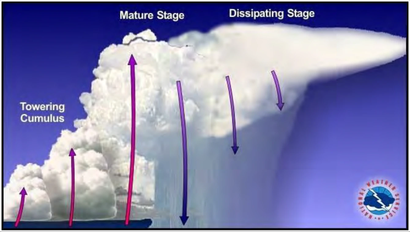
A multicell cluster thunderstorm (see Figure 22-3 and Figure 22-4) consists of a cluster of cells at various stages of their life cycle. With an organized multicell cluster, as the first cell matures, it is carried downwind, and a new cell forms upwind to take its place. A multicell cluster may have a lifetime of several hours (or more). New cells will continue to form as long as the three necessary ingredients exist (see Section 22.2). Individual cells within the cluster may move in one direction while the whole system moves in another. It can cover large areas and its persistence makes it a bit tougher to circumnavigate than a single-cell thunderstorm. An area of multicell cluster thunderstorms can be like a minefield for air traffic.
Sometimes thunderstorms will form in a narrow band or squall line that can extend laterally for hundreds of miles. Often it develops on or ahead of a cold front in moist, unstable air, but it may develop in unstable air far removed from any front. New cells continually re-form at the leading edge of the system with rain, and sometimes hail, following behind. Sometimes storms, which comprise the line, can be supercells. The line can persist for many hours (or more) as long as the three necessary ingredients continue to exist (see Section 22.2). These squall lines are the thunderstorm type which presents the most effective barrier to air traffic, because the line is usually too tall to fly over, too dangerous to fly through or under, and difficult to circumnavigate. About 25 percent of all tornadoes in the United States are spawned by squall lines.
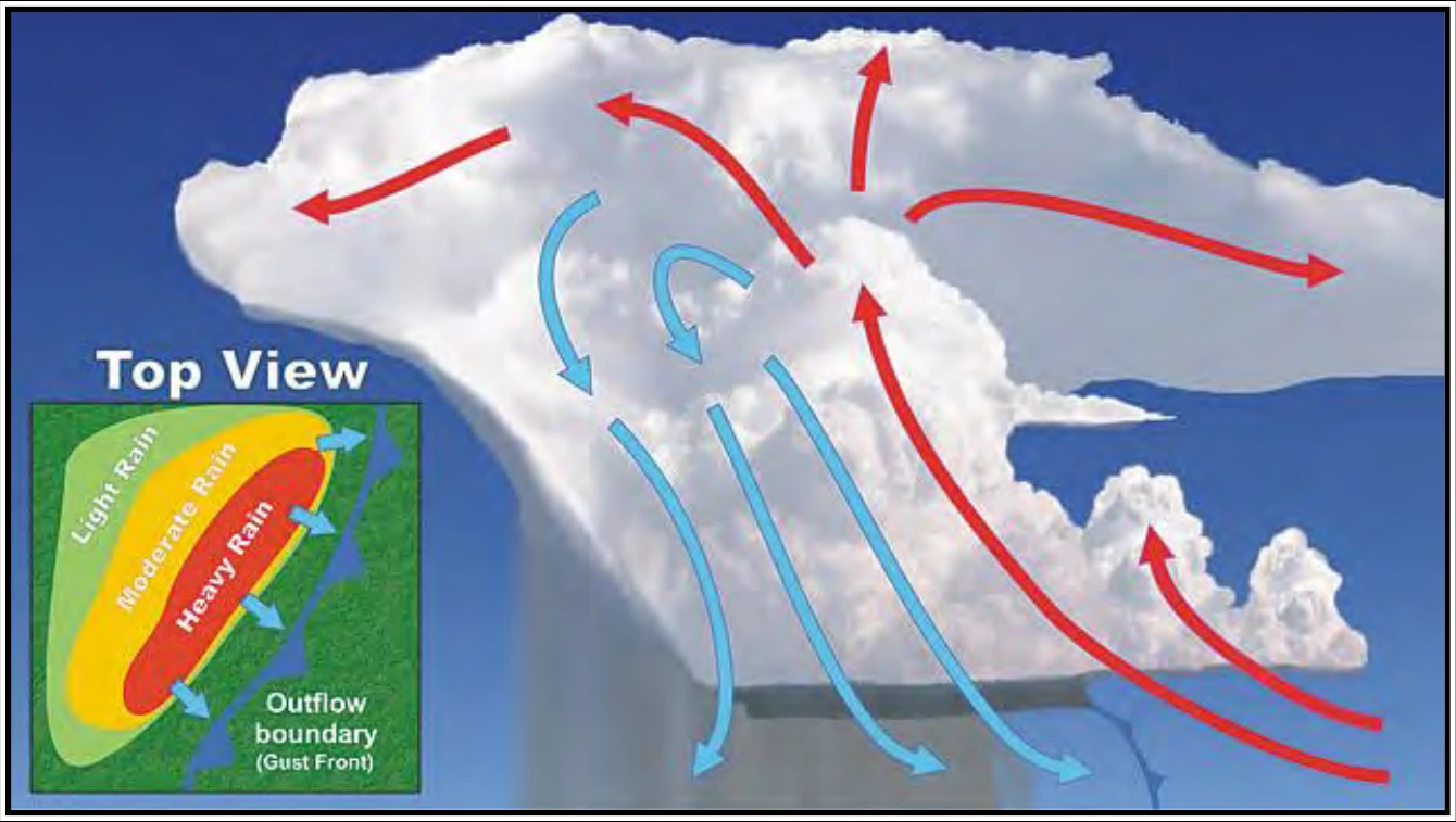
A supercell thunderstorm (see Figure 22-5) is an often dangerous, long-lived convective storm that consists primarily of a single, quasi-steady rotating updraft that persists for an extended period of time. It has a very organized internal structure that enables it to produce especially dangerous weather for pilots who encounter them. Updraft speeds may reach 9,000 fpm (100 kt). This allows hazards to be magnified to an even greater degree. Nearly all supercells produce severe weather (e.g., large hail or damaging wind) and about 25 percent produce a tornado. A supercell may persist for many hours (or longer). New cells will continue to form as long as the three necessary ingredients exist (see Section 22.2).