
Chapter 24
Observations
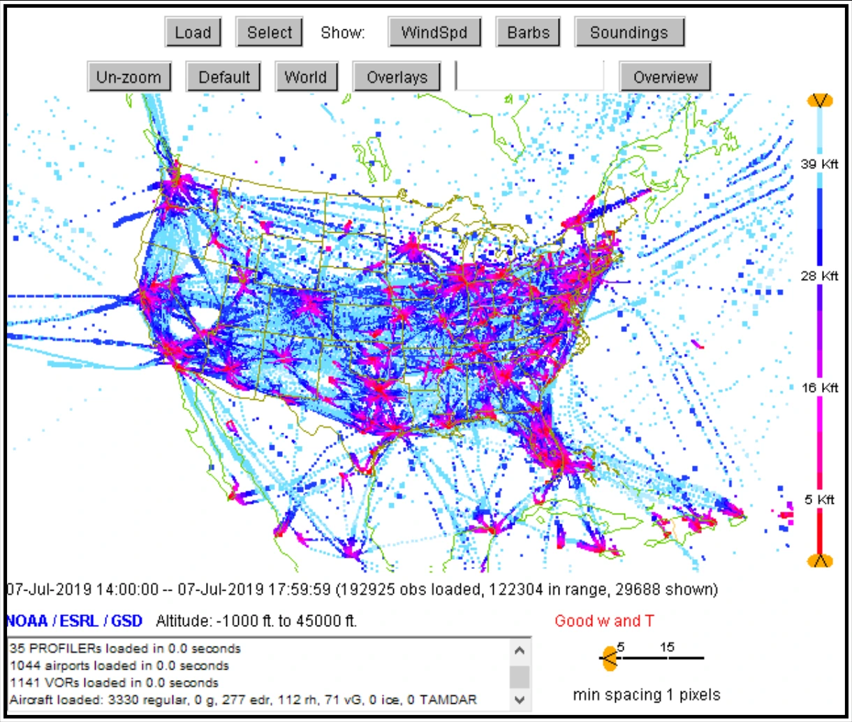
Modern commercial aircraft are equipped with meteorological sensors and associated sophisticated data acquisition and processing systems. These systems continuously record meteorological information on the aircraft and send these observations at selected intervals to ground stations via satellite or radio links where they are processed and disseminated.11 Participating airlines add turbulence information with these reports. See Figure 24-7 for a plot of AMDAR reports from 2019.
AMDAR reports turbulence in terms of Eddy Dissipation Rate (EDR). EDR is the ICAO standard dimension for automated turbulence reporting. EDR is a state of the atmosphere measure rather than a state of the aircraft measure, and is, therefore, independent of aircraft type.
24.6 Radar Observations
24.6.1 Weather Surveillance Radar—1988 Doppler (WSR-88D) Description
Weather radar observations and their resultant images are graphical displays of precipitation and non-precipitation targets detected by weather radars. WSR-88D, also known as NEXRAD, displays these targets on a variety of products, which can be found on the websites of all NWS WFOs, the AWC, the SPC, and websites and phone applications of various flight planning and weather service providers.
For information on radar basics, see Chapter 15, Weather Radar.
24.6.1.1 Issuance
WSR-88D radars are continuously generating radar observations. Each radar observation, called a volume scan, consists of 5 to 14 separate elevation “tilts,” and takes between 4 and 11 minutes to generate, depending on the radar’s mode of operation. Once one observation is complete, the next one begins. Radar observation times are not standard nor are they synchronized with other radars. The valid time of the observation is the time assigned to the product, which is the end of the last radar scan.
24.6.1.1.1 WSR-88D Radar (NEXRAD) Network
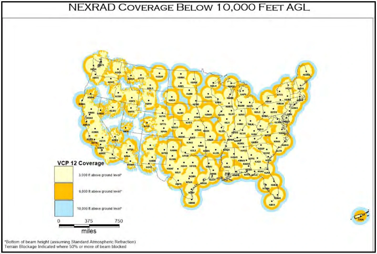
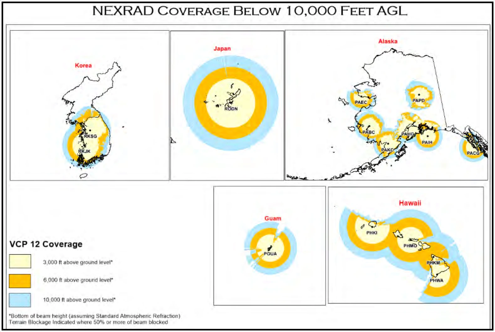
The WSR-88D radar network consists of 160 radars operated by the NWS, FAA, and DOD. Figure 24-8, Figure 24-9, and Figure 24-10 show the locations of the radars.
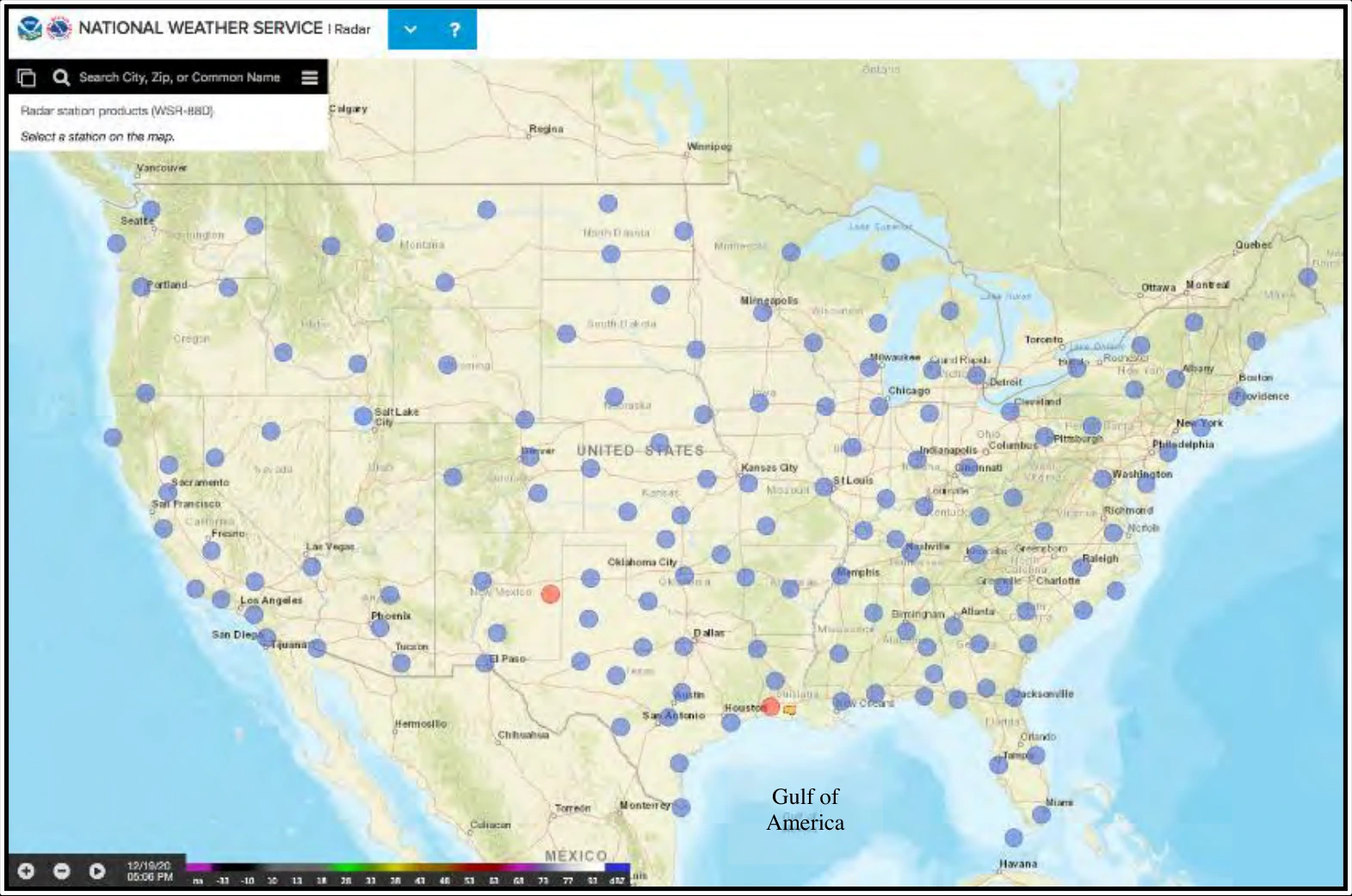
Locations of WSR-88D weather radar are indicated by gray circles. Red circles indicate radars that are temporarily out of service.
24.6.1.2 Coverage
Figure 24-9 and Figure 24-10 depict the radar coverage at 3,000 ft AGL, 6,000 ft AGL, and 10,000 ft AGL (i.e., above the height of the radar). *Several WSR-88D radars are located in mountainous areas, such as the western United States. For example, the radar in southern Utah (near Cedar City) is on top of a 10,000-ft mountain. This means that the coverage begins at 10,000 ft AGL in that area. Any precipitation from low-topped clouds would not be detected by this radar due to overshooting of the radar beam (see Section 15.2.8).