
Chapter 24
Observations
24.6.1.5.2 Composite Reflectivity
Because the highest precipitation intensity can be at any altitude, the Composite Reflectivity product (see Figure 24-12) is needed. Composite Reflectivity is the maximum echo intensity (reflectivity) detected within a column of the atmosphere above a location. During its tilt sequence, the radar scans through all of the elevation slices to determine the highest decibel value in the vertical column (see Figure 24-13), then displays that value on the product. When compared with Base Reflectivity, the Composite Reflectivity can reveal important storm structure features and intensity trends of storms (see Figure 24-14).
NEXRAD radar displays on airplane avionics use the Composite Reflectivity data for their radar mosaics.
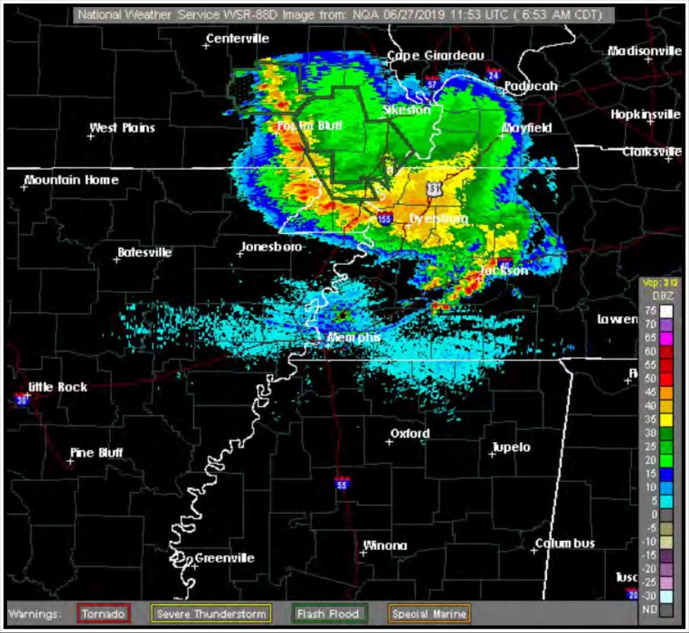
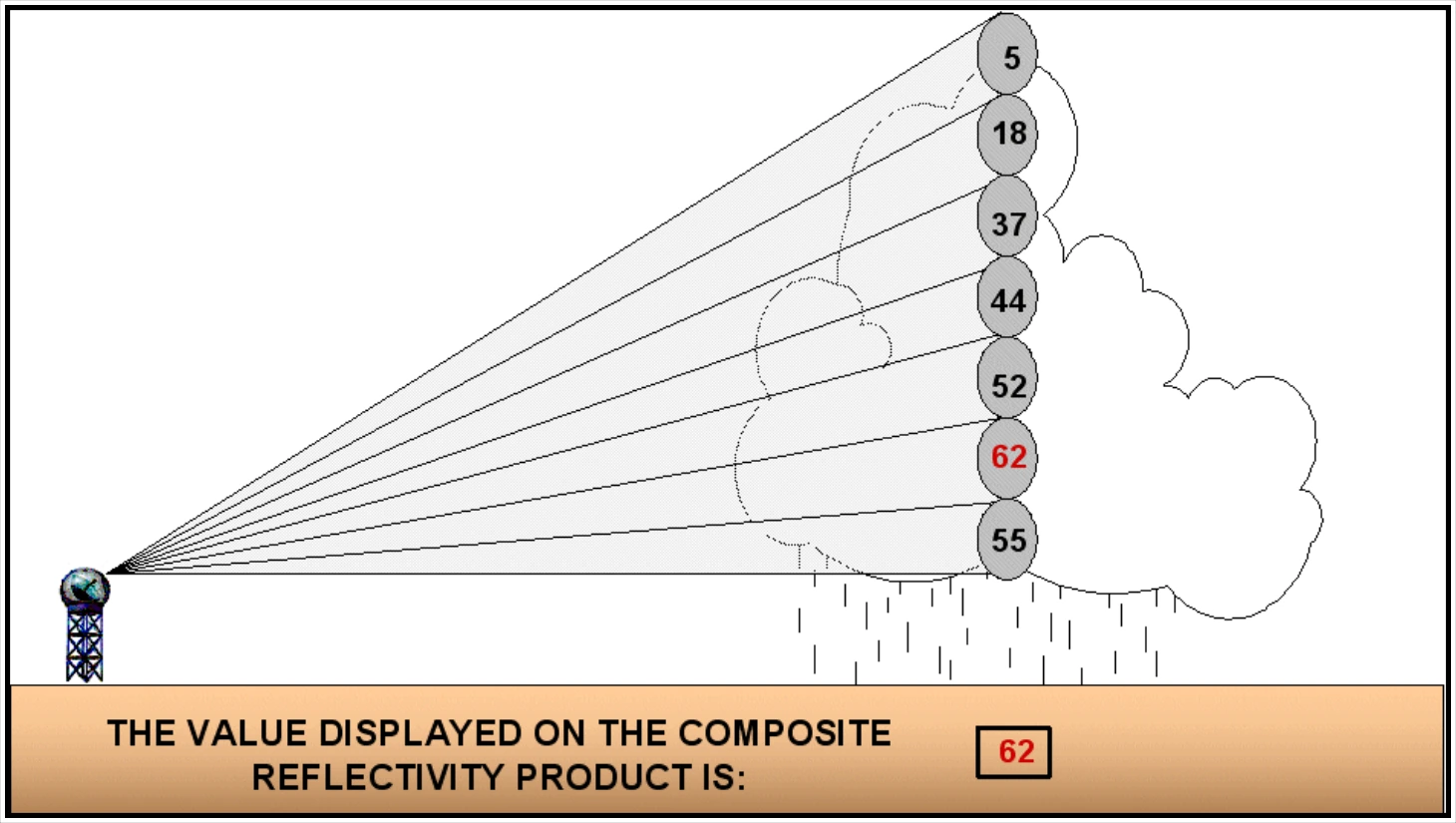
The Composite Reflectivity product displays the highest reflectivity of all elevation scans.
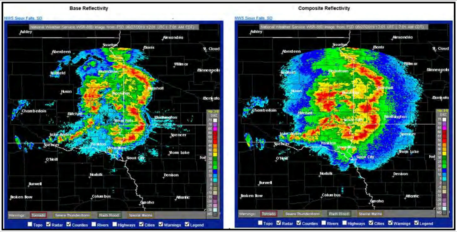
This Composite Reflectivity shows that in many locations the highest precipitation intensity occurs at an altitude higher than precipitation detected at the elevation of the base elevation angle.
24.6.1.5.3 Base Reflectivity
The Base Reflectivity product is a display of both the location and intensity of reflectivity data from the lowest elevation angle scan, or 0.5° above the horizon. Base Reflectivity is also known as “Lowest Tilt” and “Reflectivity at Lowest Altitude,” depending on the website or weather data service provider.
The Base Reflectivity product is one elevation scan, whereas Composite Reflectivity looks at all elevation scans. Base Reflectivity products are available several minutes sooner than Composite Reflectivity products. Precipitation at any location may be heavier than depicted on the Base Reflectivity image because it is occurring above the lowest elevation angle.
Depending on the radar website or service provider, the range of the Base Reflectivity single-site radar product is either 124 NM or 248 NM. When using a single-site radar (i.e., not using a radar mosaic), echoes farther than 124 NM from the radar site might not be displayed, even if precipitation may be occurring at these greater distances.
24.6.1.5.4 Echo Tops
An Echo Tops product provides an estimation of the top of the precipitation by using the height of 18 dBZ radar echo above sea level. Cloud tops will be higher than the top of the precipitation.
24.6.1.6 Limitations
Limitations associated with Composite Reflectivity and Base Reflectivity images include:
- The radar beam may overshoot or undershoot targets (see Section 15.2.8).
- Also, the image may be contaminated by (see Sections 15.2.9 through 15.2.14):
- Beam blockage.
- Ground clutter.
- Ghosts.
- Angels.
- Anomalous Propagation (AP).
- Other non-meteorological phenomena.
Limitations associated with mosaics include:
- Datalinked mosaic radar imagery shows where the precipitation was, not where the precipitation is occurring. The displayed radar precipitation may be 15 to 20 minutes older than the age indicated on the display.