
Chapter 27
Forecasts
The Aviation Surface Forecast and Aviation Clouds Forecast graphics are snapshot images derived from a subset of the aviation weather forecasts within the GFA Tool (see Chapter 28, Aviation Weather Tools). A CONUS view is available as well as several regional views. Forecasts are provided for 3, 6, 9, 12, 15, and 18 hours.
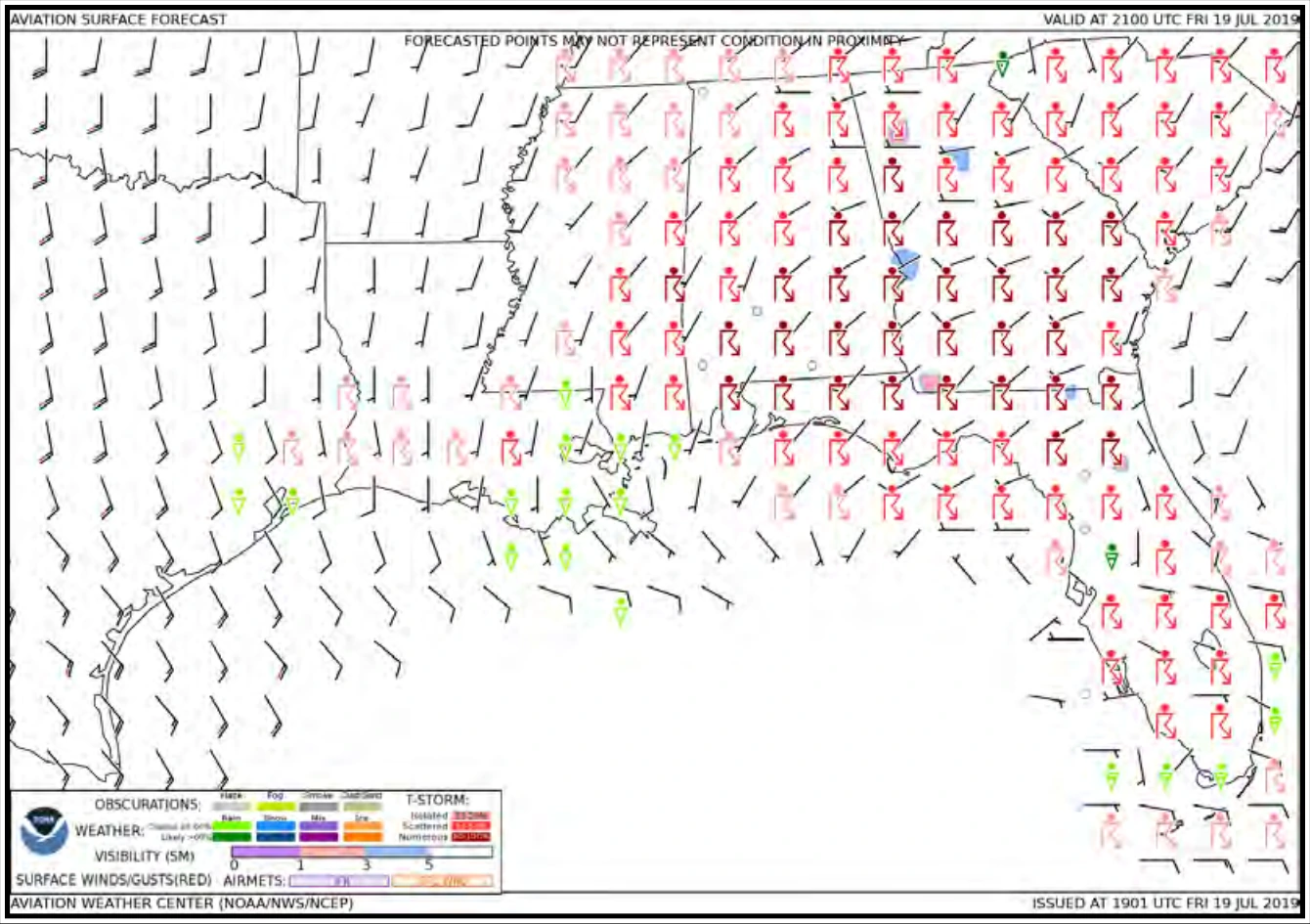
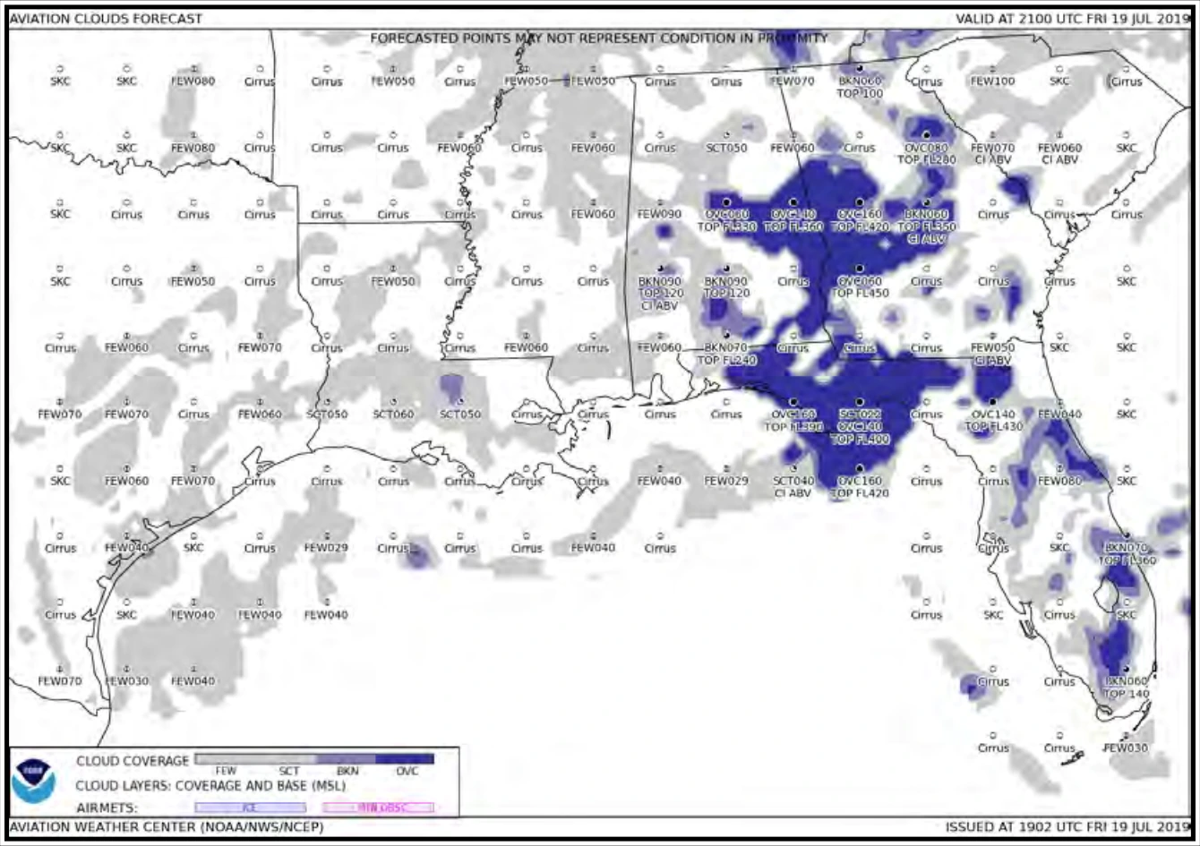
The Aviation Surface Forecast (see Figure 27-1) provides obscurations, visibility, weather phenomena, and winds (including wind gusts) with AIRMET Sierra for IFR conditions and AIRMET Tango for sustained surface winds of 30 kt or more overlaid. The Aviation Clouds Forecast (see Figure 27-2) provides cloud coverage, bases, layers, and tops with AIRMET Sierra for mountain obscuration and AIRMET Zulu for icing overlaid.
The Aviation Clouds Forecast graphic provides a forecast of cloud coverage and height (in hundreds of feet MSL). Tops of the highest broken (BKN) or overcast (OVC) layer are shown when bases are below FL180. Overlays of AIRMETs for icing and mountain obscuration are included when applicable.
Both of these products are updated every three hours and provide forecast snapshots for 3, 6, 9, 12, 15, and 18 hours in the future.
These forecasts are presented on regional maps as well as a CONUS map. The regional maps provide more detail than the CONUS map. The NWS plans to expand the coverage beyond the CONUS.
Complete product information can be found on the AWC’s website.
27.6 Area Forecasts (FA)
An FA is an abbreviated plain language (text) forecast concerning the occurrence or expected occurrence of specified en route weather phenomena. FAs cover an 18- to 24-hour period, depending on the region, are issued three to four times daily, depending on the region, and are updated as needed. The exact phenomenon contained in FAs also varies by region.
Text FAs are produced by the NWS for Alaska. They are available at https://aviationweather.gov. Text FAs for the CONUS, Hawaii, the Gulf of America, and the Caribbean have been retired and replaced by the NWS’ GFA Tool (see Chapter 28) and the Aviation Surface Forecast and Aviation Clouds Forecast graphics (see Section 27.5). The NWS will continue producing text FAs for Alaska for the foreseeable future.
27.6.1 FA Standardization
Alaska FAs follow these standards:
- All heights or altitudes are referenced to MSL, unless otherwise noted (i.e., prefaced by AGL or CIG), and annotated using the height in hundreds of feet, consisting of three digits (e.g., 040). For heights at or above 18,000 ft, the level is preceded by “FL” to represent flight levels (e.g., FL180). Tops are always referenced to MSL.
- References to latitude and longitude are in whole degrees and minutes following the model: Nnn[nn] or Snn[nn], Wnnn[nn], or Ennn[nn] with a space between latitude and longitude and a hyphen between successive points (e.g., N3106 W07118 – N3011 W7209).
- Messages are prepared in abbreviated plain language using contractions from Order JO 7340.2, Contractions, for domestic products, and from ICAO Doc 8400, ICAO Abbreviations and Codes, for products issued for Oceanic FIRs. A limited number of non-abbreviated words, geographical names, and numerical values of a self-explanatory nature may also be used.
- Weather and obstructions to visibility are described using the weather abbreviations for surface weather observations (METAR/SPECI) (see Section 24.3).
27.6.2 FA Issuance Schedule
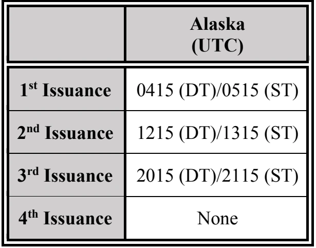
FAs for Alaska are scheduled products issued at the times listed in Table 27-8 below.
27.6.3 FA Amendments and Corrections
Amendments are issued whenever the weather significantly improves or deteriorates based upon the judgment of the forecaster. AMD is included after the date/time group. The date/time group on the WMO and FAA lines is updated to indicate the time of the correction. The ending valid time remains unchanged.