
Chapter 27
Forecasts
27.18 Route Forecast (ROFOR)
The ROFOR product is no longer issued by the NWS and has been replaced by the GFA in the Pacific. See Section 28.2 for information on the GFA.
27.19 Aviation Forecast Discussion (AFD)
AFDs describe the weather conditions within a multistate or substate-sized area. They also may:
- Describe the weather conditions as they relate to a specific TAF or group of TAFs; and
- Provide additional aviation weather-related issues that cannot be encoded into the TAF, such as the reasoning behind the forecast.
AFDs are a free-form plain language text product. Common or well-known aviation weather contractions are used as well as local or regional geographic names, such as valleys, mountain ranges, and bodies of water.
Technically, the AFD is not a discrete product; it is the aviation section in the NWS WFO’s AFD. The NWS AWC extracts the aviation section from the WFO’s AFD and makes it available on the AWC’s website under the Forecasts tab, titled “Avn. Forecast Disc.” The aviation section of the AFD can also be found on the WFO’s website under “Forecaster Discussion.”
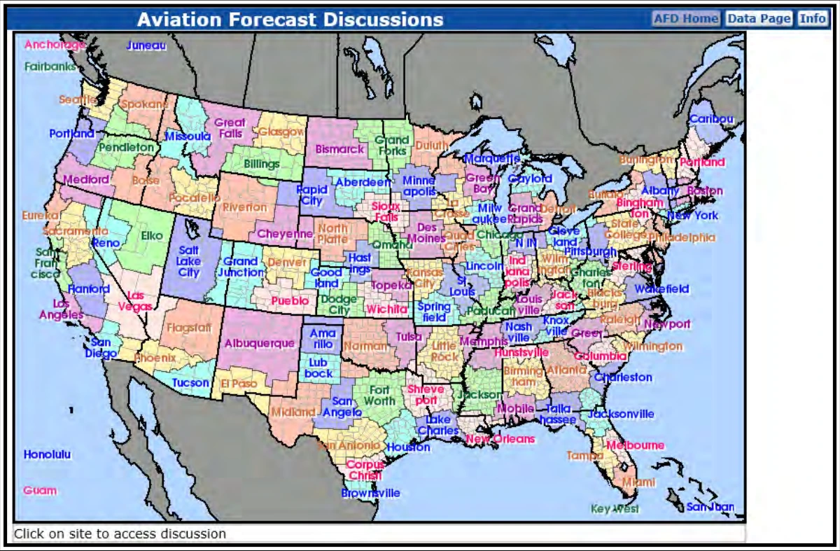
All WFOs in the CONUS, and most outside the CONUS, produce the aviation section of the AFD for their area of responsibility (see Figure 27-34). They are issued roughly every six hours and correspond to the issuance of TAFs from the respective NWS WFO. Each NWS office may tailor the format to meet the needs of their local aviation users.
27.19.1 Example
NWS Boise, ID
COLD FRONT CURRENTLY OVER SW IDAHO WEST OF THE MAGIC VALLEY. IFR IN HEAVIER
RAIN/SNOW SHOWERS BEHIND THE FRONT MOSTLY IN THE MTNS UNTIL THIS EVENING.
OTHERWISE, LOW VFR THROUGH TOMORROW WITH ISOLATED SHOWERS INTO THE EVENING.
SURFACE WINDS...W TO NW WITH GUSTS 20-30 KTS...BECOMING 35-45 KTS IN THE UPPER
TREASURE AND MAGIC VALLEYS FOR A FEW HOURS THIS AFTERNOON...DROPPING DOWN TO
20-30 KTS OVERNIGHT INTO THE MORNING IN THE MAGIC VALLEY AND 5-10 KTS ELSEWHERE.
WINDS ALOFT NEAR 10K FT MSL...NW 30-40 KTS...40-50 KTS OVER THE UPPER TREASURE
AND MAGIC VALLEYS OVERNIGHT...BECOMING 20-30 KTS BY 15/12Z.
27.20 Meteorological Impact Statement (MIS)
The MIS is a nontechnical plain language product intended primarily for FAA traffic managers and those involved in planning aircraft routing. MISs are issued by the NWS CWSU.
MISs are available on the AWC’s website as well as CWSU’s websites.
The MIS valid times are determined according to local policy. The MIS is limited to a 48-hour valid period.
27.20.1 Example
ZAB MIS 02 VALID 281300-290300
...FOR ATC PLANNING PURPOSES ONLY...
AN UPPER-LVL DISTURBANCE OVER COLORADO COMBINED WITH A STRONG JET STREAM MOVING
ACROSS THE SWRN U.S. IS FCST TO PRODUCE AREAS OF TURBULENCE ACROSS PORTIONS OF
ZAB. THE TURBULENCE IS FCST TO SUBSIDE AFT 00Z AS THE DISTURBANCE AND JETSTREAM
MOVE FURTHER EAST.
27.21 Soaring Forecast
Select NWS WFOs issue soaring forecasts. These are automated forecasts primarily derived from the radiosonde observation or model-generated soundings.
The content and format of soaring forecasts vary with the NWS WFO-provided forecast, based on the needs of their soaring community. It is beyond the scope of this handbook to describe all of the many variations of soaring forecasts and their content. Soaring pilots should consult with the NWS WFO in their soaring area for more information.