Chapter 5
Flight Instruments
The introduction of the Global Positioning System (GPS) has provided extremely precise position at low cost, making GPS the dominant FMS navigation sensor today. Currently, typical FMS installations require that air data and heading information be available electronically from the aircraft. This limits FMS usage in smaller aircraft, but emerging technologies allow this data from increasingly smaller and less costly systems. Some systems interface with a dedicated Distance Measuring Equipment (DME) receiver channel under the control of the FMS to provide an additional sensor. In these systems, the FMS determines which DME sites should be interrogated for distance information using aircraft position and the navigation database to locate appropriate DME sites. The FMS then compensates aircraft altitude and station altitude with the aid of the database to determine the precise distance to the station. With the distances from a number of sites the FMS can compute a position nearly as accurately as GPS.
Aimer visualized three-dimensional aircraft control with an FMS. Modern systems provide Vertical Navigation (VNAV) as well as Lateral Navigation (LNAV) allowing the pilot to create a vertical flight profile synchronous with the lateral flight plan. Unlike early systems, such as Inertial Reference Systems (IRS) that were only suitable for en route navigation, the modern FMS can guide an aircraft during instrument approaches.
Today, an FMS provides not only real-time navigation capability but typically interfaces with other aircraft systems providing fuel management, control of cabin briefing and display systems, display of uplinked text and graphic weather data and air/ground data link communications.
Electronic Flight Instrument Systems
Modern technology has introduced into aviation a new method of displaying flight instruments, such as electronic flight instrument systems, integrated flight deck displays, and others. For the purpose of the practical test standards, any flight instrument display that utilizes LCD or picture tube like displays is referred to as “electronic flight instrument display” and/or a glass flight deck. In general aviation there is typically a primary flight display (PFD) and a multi-function display (MFD). Although both displays are in many cases identical, the PFD provides the pilot instrumentation necessary for flight to include altitude, airspeed, vertical velocity, attitude, heading and trim and trend information.
Glass flight decks (a term coined to describe electronic flight instrument systems) are becoming more widespread as cost falls and dependability continually increases. These systems provide many advantages such as being lighter, more reliable, no moving parts to wear out, consuming less power, and replacing numerous mechanical indicators with a single glass display. Because the versatility offered by glass displays is much greater than that offered by analog displays, the use of such systems only increases with time until analog systems are eclipsed.
Primary Flight Display (PFD)
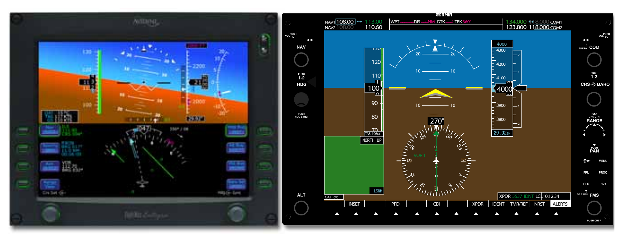
PFDs provide increased situational awareness (SA) to the pilot by replacing the traditional six instruments used for instrument flight with an easy-to-scan display that provides the horizon, airspeed, altitude, vertical speed, trend, trim, rate of turn among other key relevant indications. Examples of PFDs are illustrated in Figure 5-45.
Synthetic Vision
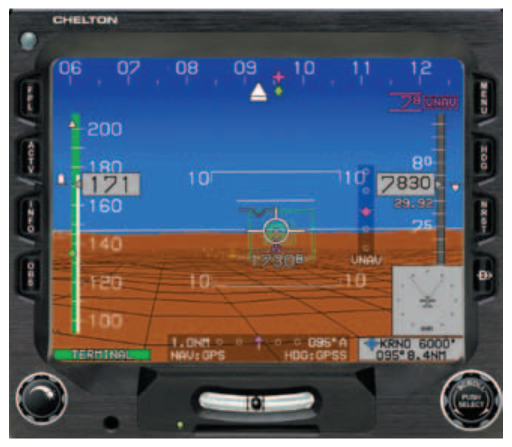
Synthetic vision provides a realistic depiction of the aircraft in relation to terrain and flightpath. Systems such as those produced by Chelton Flight Systems, Universal Flight Systems, and others provide for depictions of terrain and course. Figure 5-46 is an example of the Chelton Flight System providing both 5-dimensional situational awareness and a synthetic highway in the sky, representing the desired flightpath. Synthetic vision is used as a PFD, but provides guidance in a more normal, outside reference format.
Multi-Function Display (MFD)
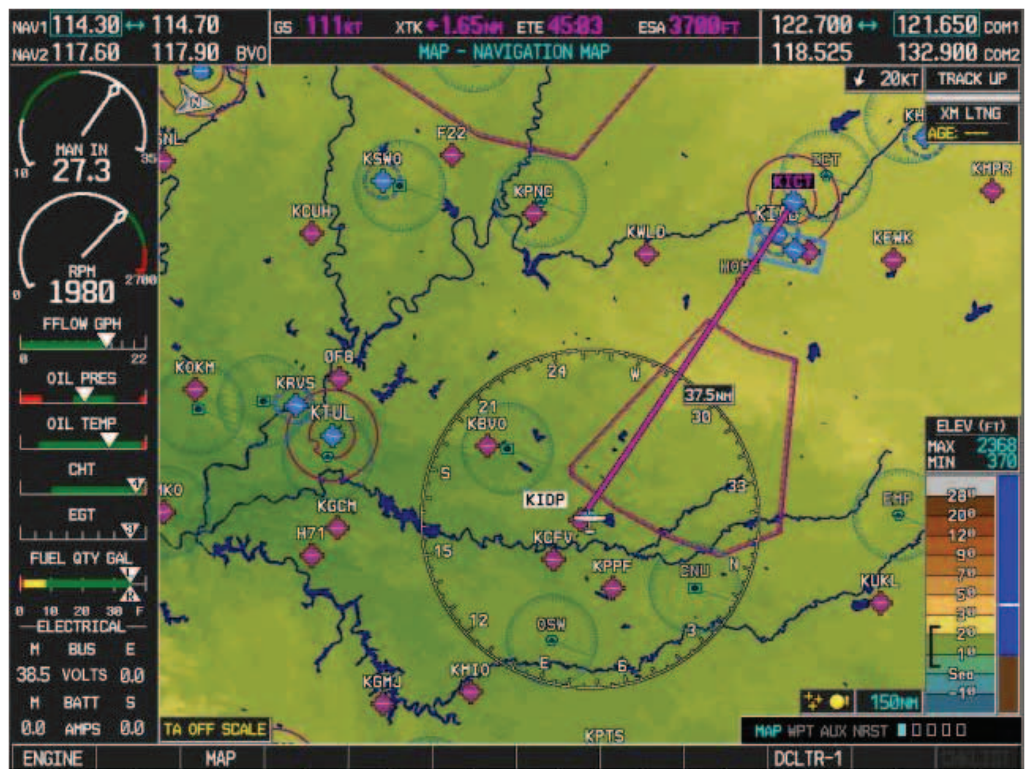
In addition to a PFD directly in front of the pilot, an MFD that provides the display of information in addition to primary flight information is used within the flight deck. [Figure 5-47] Information such as a moving map, approach charts, Terrain Awareness Warning System, and weather depiction can all be illustrated on the MFD. For additional redundancy both the PFD and MFD can display all critical information that the other normally presents thereby providing redundancy (using a reversionary mode) not normally found in general aviation flight decks.
Advanced Technology Systems
Automatic Dependent Surveillance—Broadcast (ADS-B)
Although standards for Automatic Dependent Surveillance (Broadcast) (ADS-B) are still under continuing development, the concept is simple: aircraft broadcast a message on a regular basis, which includes their position (such as latitude, longitude and altitude), velocity, and possibly other information. Other aircraft or systems can receive this information for use in a wide variety of applications. The key to ADS-B is GPS, which provides three-dimensional position of the aircraft.
As an simplified example, consider air-traffic radar. The radar measures the range and bearing of an aircraft. The bearing is measured by the position of the rotating radar antenna when it receives a reply to its interrogation from the aircraft, and the range by the time it takes for the radar to receive the reply.
An ADS-B based system, on the other hand, would listen for position reports broadcast by the aircraft. [Figure 5-48] These position reports are based on satellite navigation systems. These transmissions include the transmitting aircraft’s position, which the receiving aircraft processes into usable pilot information. The accuracy of the system is now determined by the accuracy of the navigation system, not measurement errors. Furthermore the accuracy is unaffected by the range to the aircraft as in the case of radar. With radar, detecting aircraft speed changes require tracking the data and changes can only be detected over a period of several position updates. With ADS-B, speed changes are broadcast almost instantaneously and received by properly equipped aircraft. Additionally, other information can be obtained by properly equipped aircraft to include notices to airmen (NOTAM), weather, etc. [Figures 5-49 and 5-50] At the present time, ADS-B is predominantly available along the east coast of the United States where it is matured.