
Chapter 2
En Route Operations
Changeover Points
When flying airways, pilots normally change frequencies midway between NAVAIDs, although there are times when this is not practical. If the navigation signals cannot be received from the second VOR at the midpoint of the route, a COP is depicted and shows the distance in NM to each NAVAID. [Figure 2-42] COPs indicate the point where a frequency change is necessary to receive course guidance from the facility ahead of the aircraft instead of the one behind. These COPs divide an airway or route segment and ensure continuous reception of navigation signals at the prescribed minimum en route IFR altitude. They also ensure that other aircraft operating within the same portion of an airway or route segment receive consistent azimuth signals from the same navigation facilities regardless of the direction of flight.
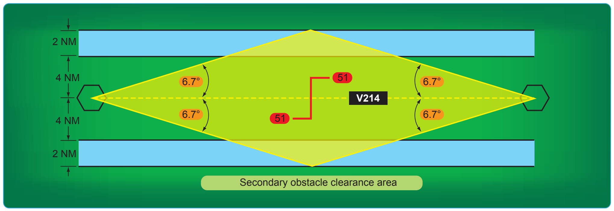
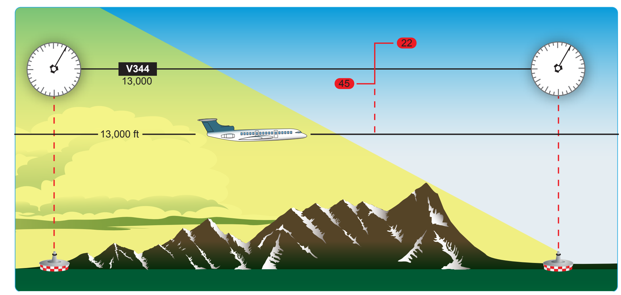
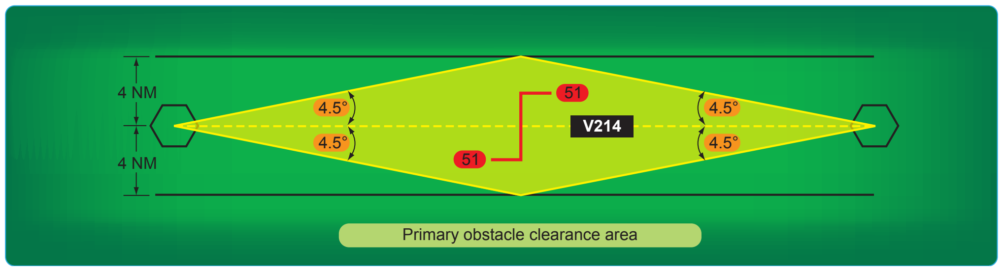
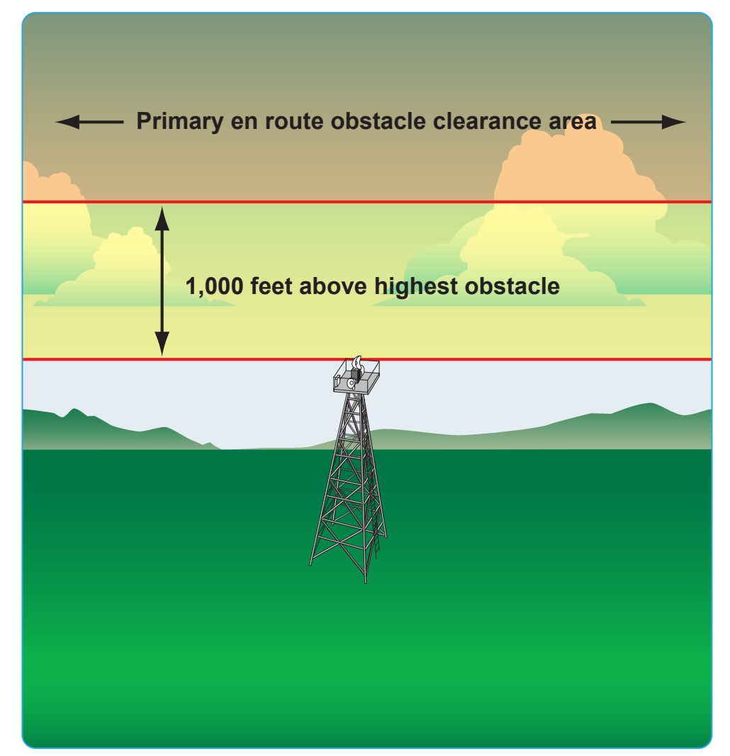
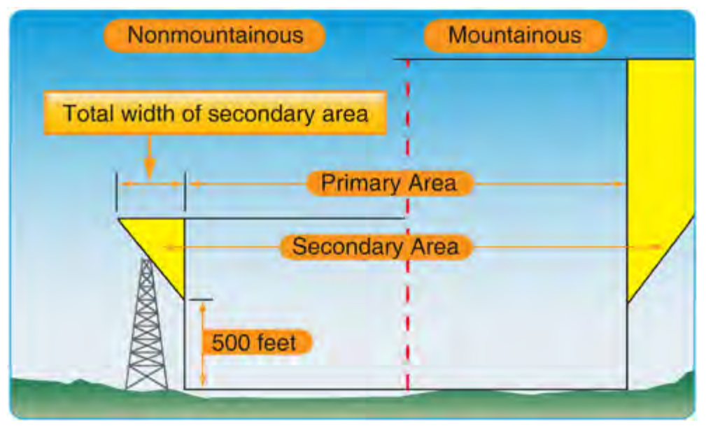
Where signal coverage from two VORs overlaps at the MEA, the COP normally is designated at the midpoint. Where radio frequency interference or other navigation signal problems exist, the COP is placed at the optimum location, taking into consideration the signal strength, alignment error, or any other known condition that affects reception. The COP has an effect on the primary and secondary obstacle clearance areas. On long airway or route segments, if the distance between two facilities is over 102 NM and the COP is placed at the midpoint, the system accuracy lines extend beyond the minimum widths of 8 and 12 NM, and a flare or spreading outward results at the COP. [Figure 2-43] Offset COP and dogleg segments on airways or routes can also result in a flare at the COP.
Direct Route Flights
Direct route flights are flights that are not flown on the radials or courses of established airways or routes. Direct route flights must be defined by indicating the radio fixes over which the flight passes. Fixes selected to define the route should be those over which the position of the aircraft can be accurately determined. Such fixes automatically become compulsory reporting points for the flight, unless advised otherwise by ATC. Only those NAVAIDs established for use in a particular structure (i.e., in the low or high structures) may be used to define the en route phase of a direct flight within that altitude structure.
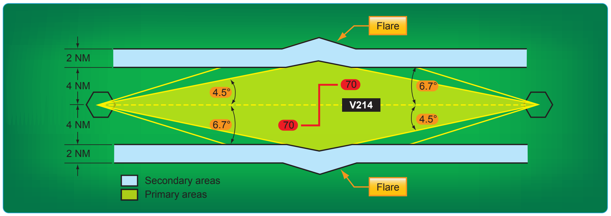
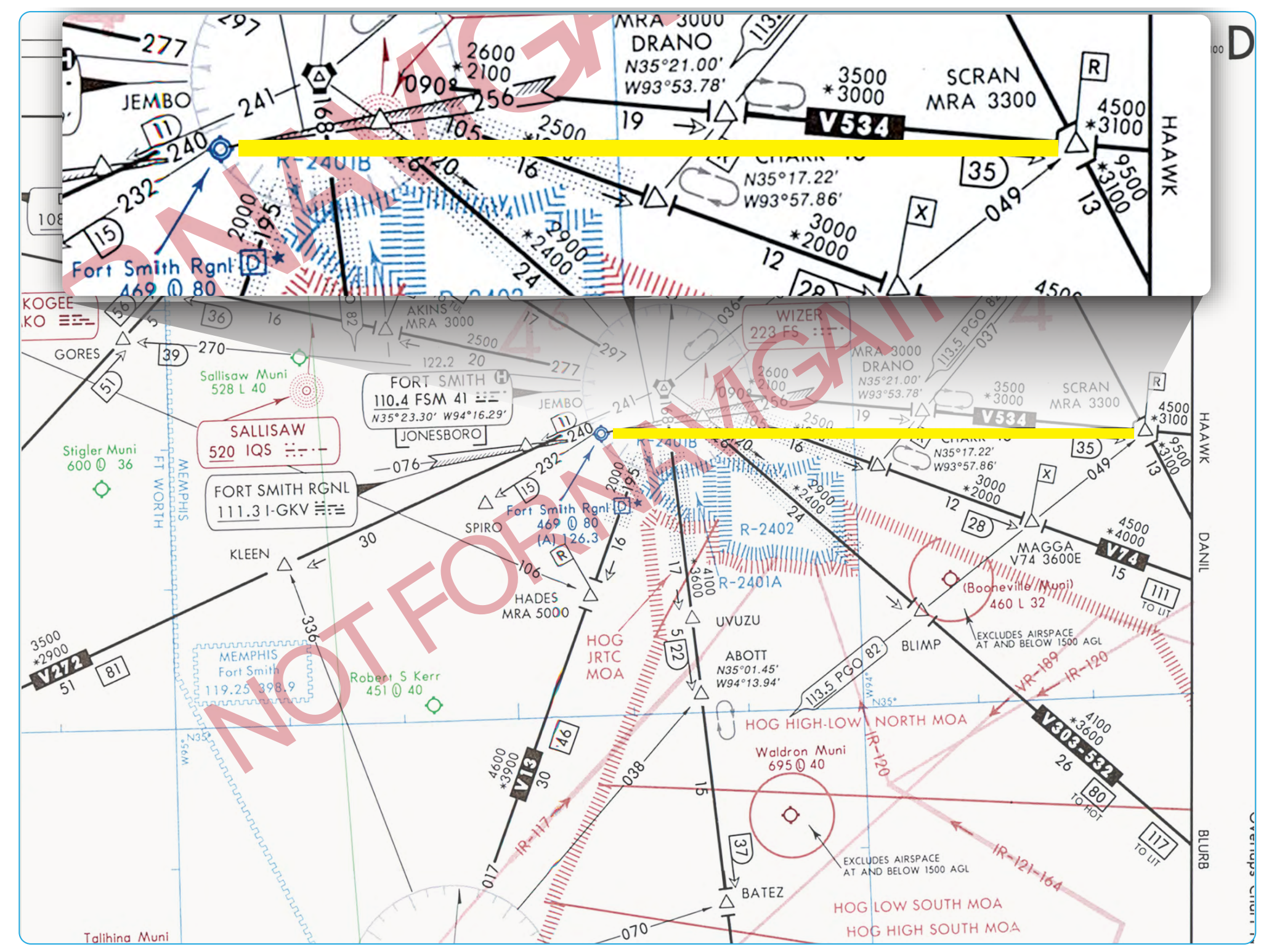
Figure 2-44 shows a straight line on a magnetic course from SCRAN intersection of 270° direct to the Fort Smith Regional Airport in Arkansas that passes just north of restricted areas R-2401A and B and R-2402. Since the airport and the restricted areas are precisely plotted, there is an assurance that you will stay north of the restricted areas. From a practical standpoint, it might be better to fly direct to the Wizer NDB. This route goes even further north of the restricted areas and places you over the final approach fix to Runway 25 at Fort Smith.
The azimuth feature of VOR aids and the azimuth and distance (DME) features of VORTAC and TACAN aids are assigned certain frequency protected areas of airspace that are intended for application to established airway and route use and to provide guidance for planning flights outside of established airways or routes. These areas of airspace are expressed in terms of cylindrical service volumes of specified dimensions called class limits or categories.
An operational service volume has been established for each class in which adequate signal coverage and frequency protection can be assured. To facilitate use of VOR, VORTAC, or TACAN aids, consistent with their operational service volume limits, pilot use of such aids for defining a direct route of flight in controlled airspace should not exceed the following:
- Operations above FL 450—use NAVAIDs not more than 200 NM apart. These aids are depicted on en route high altitude charts.
- Operation off established routes from 18,000 feet MSL to FL 450—use NAVAIDs not more than 260 NM apart. These aids are depicted on en route high altitude charts.
- Operation off established airways below 18,000 feet MSL—use NAVAIDs not more than 80 NM apart. These aids are depicted on en route low altitude charts.
- Operation off established airways between 14,500 feet MSL and 17,999 feet MSL in the conterminous United States—(H) facilities not more than 200 NM apart may be used.
Increasing use of self-contained airborne navigational systems that do not rely on the VOR/VORTAC/TACAN system has resulted in pilot requests for direct routes that exceed NAVAID service volume limits. These direct route requests are approved only in a radar environment with approval based on pilot responsibility for navigation on the authorized direct route. Radar flight following is provided by ATC for ATC purposes. At times, ATC initiates a direct route in a radar environment that exceeds NAVAID service volume limits. In such cases, ATC provides radar monitoring and navigational assistance as necessary.
When filing for a direct route flight, airway or jet route numbers, appropriate to the stratum in which operation is conducted, may also be included to describe portions of the route to be flown. The following is an example of how a direct route flight would be written.
MDW V262 BDF V10 BRL STJ SLN GCK
Spelled out: from Chicago Midway Airport via Victor 262 to Bradford, Victor 10 to Burlington, Iowa, direct St. Joseph, Missouri, direct Salina, Kansas, direct Garden City, Kansas.