User-friendly explanations of instrument approach charts, planviews, profiles, minimums, airport diagrams, departures, arrivals, and visual procedures.
Airports
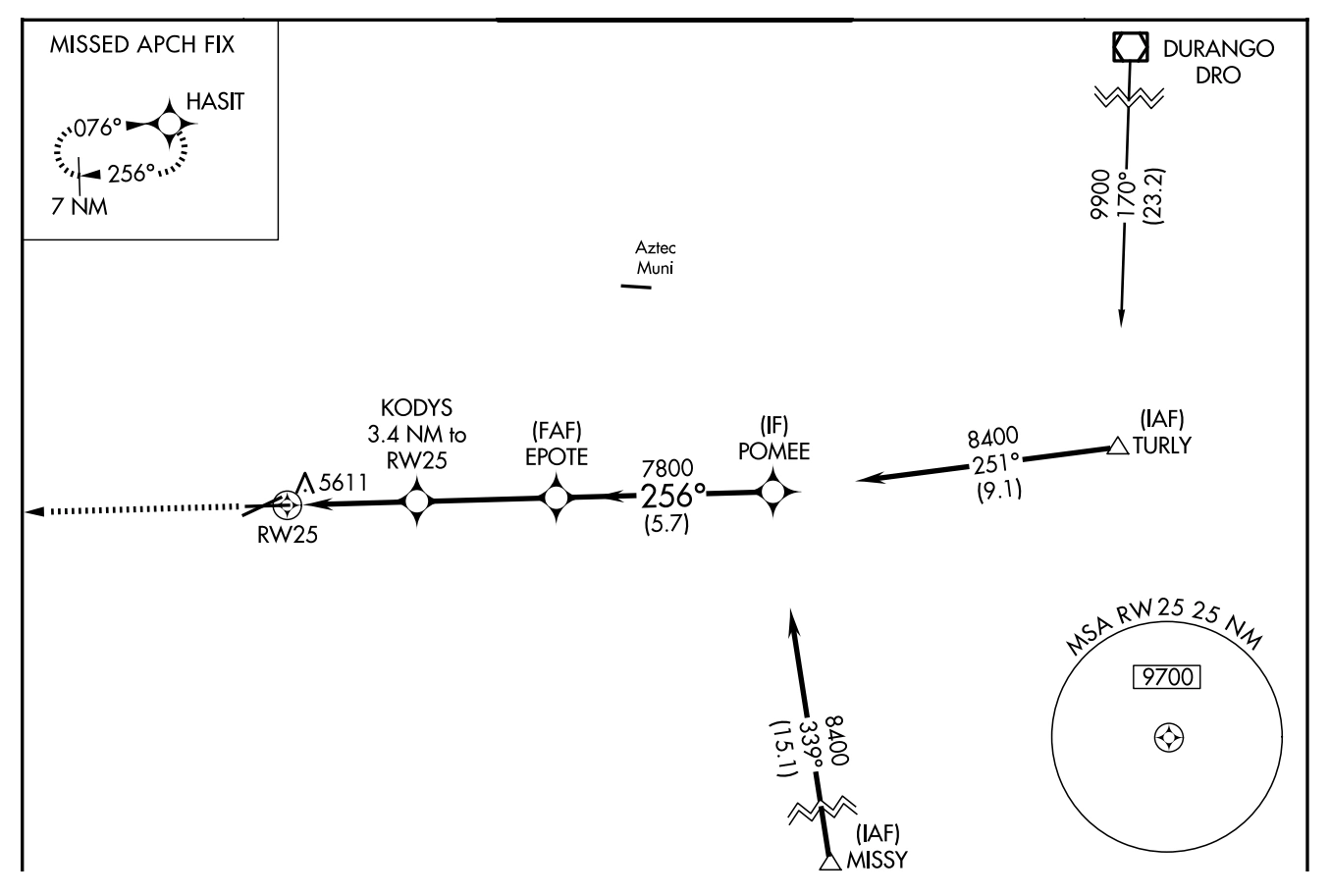
The primary approach airport is shown to scale by a pattern of all the runways. Airports other than the primary approach airport may be shown with an airport pattern and name when in close proximity to the primary airport.
Instrument approach planview showing primary and nearby airports — source page 110.
Holding Patterns and Procedure Turns Holding Patterns are used for many reasons, including deteriorating weather or high traffic volume. Holding might also be required following a missed approach. Each holding pattern has a fix, a direction to hold from the fix, and an airway, bearing, course, radial, or route on which the aircraft is to hold. These elements, along with the direction of the turns, define the holding pattern. Holding Patterns may not always be depicted to scale. Missed Approach Hold In-Lieu of Procedure Turn Arrival If a holding pattern has a non-standard speed restriction, it will be depicted by an icon with the limiting air speed shown inside the holding pattern symbol. These elements, along with the direction of the turns, define the holding pattern. If two types of holds are located at the same point, the procedural holding pattern will be shown in-lieu of arrival or missed approach holding patterns. Timing or distance limits for Hold-in-lieu of Procedure Turn Holding Patterns will be shown. Waypoints designated as a holding fix are shown as fly-by, without the circle around the symbol. However, in the event the holding fix/waypoint is also designated in all other parts of the procedure unrelated to holding with a fly-over function, then the holding fix/waypoint will be charted as a fly-over point. A procedure turn (PT) is the maneuver prescribed to perform a course reversal to establish the aircraft inbound on an intermediate or final approach course. The procedure turn or hold-in-lieu-of procedure turn is a required maneuver when it is depicted on the approach chart. However, the procedure turn or the hold-in-lieu-of PT is not permitted when the symbol “NoPT” is depicted on the initial segment being flown, when a RADAR VECTOR to the final approach course is provided, or when conducting a timed approach from a holding fix. The procedure turn will be shown in the planview and in the profile of the chart. In the planview, the tip of the procedure turn barb is shown at the procedure turn limit, e.g., 10 NM, 15 NM. Users should be aware that it is possible for there to be a terminal/feeder fix along the procedure track that is not associated with the procedure turn. Fixes associated with the procedure turn are depicted in the profile. Airports The primary approach airport is shown to scale by a pattern of all the runways. Airports other than the primary approach airport may be shown with an airport pattern and name when in close proximity to the primary airport.
Source page 111
Relief (Contours)
Relief (Contours) is depicted in the planview portion of all IAPs at airports that meet the following criteria:
If the terrain within the planview exceeds 4,000 feet above the airport elevation, or
If the terrain within a 6.0 nautical mile radius of the Airport Reference Point (ARP) rises to at least 2,000 feet above the airport elevation.
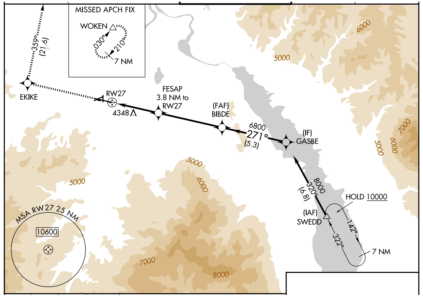
When an airport meets either of the above criteria, terrain will be charted by gradient tints of brown on all IAPs for that airport. Contour layers will be shown in no more than five brown tints, with consecutively darker tints used for consecutively higher elevation contour layers.
Relief contours and gray hydrography on an IAP planview — source page 111.
Hydrography (Water)
Water Depiction is depicted in grey, in the planview portion of IAPs. See previous example. The following hydrographic features are shown:
Oceans
Significant rivers and streams
Significant lakes - If only one river or one small lake is involved, not located in the immediate airport vicinity, the hydrographic information requirement may be waived.
International Boundary
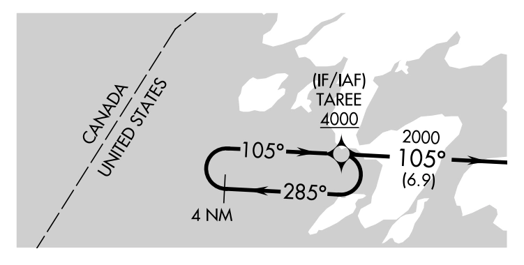
When the planview includes a boundary of another country the International boundaries are shown by a dashed line. International boundaries are identified with country name within the country area.
International boundary and water depiction on an instrument approach chart — source page 111.
Relief (Contours) Relief (Contours) is depicted in the planview portion of all IAPs at airports that meet the following criteria: • If the terrain within the planview exceeds 4,000 feet above the airport elevation, or • If the terrain within a 6.0 nautical mile radius of the Airport Reference Point (ARP) rises to at least 2,000 feet above the airport elevation. When an airport meets either of the above criteria, terrain will be charted by gradient tints of brown on all IAPs for that airport. Contour layers will be shown in no more than five brown tints, with consecutively darker tints used for consecutively higher elevation contour layers. Hydrography (Water) Water Depiction is depicted in grey, in the planview portion of IAPs. See previous example. The following hydrographic features are shown: • Oceans • Significant rivers and streams • Significant lakes - If only one river or one small lake is involved, not located in the immediate airport vicinity, the hydrographic information requirement may be waived. International Boundary When the planview includes a boundary of another country the International boundaries are shown by a dashed line. International boundaries are identified with country name within the country area.
Source page 112
Obstacles
Procedural obstacles specifically indicated for charting by the approving authority will be charted. Obstacles identified as vegetation or ships will be indicated by a doubtful accuracy symbol following the elevation value.
Cookie Preferences
We use cookies to operate this website, improve performance, understand site traffic, and personalize your experience. Essential cookies are always active because they are required for the website to function.
Required for basic site functionality and security.
Help us understand how visitors use the website so we can improve it.
May be used for advertising, remarketing, or social media features.
You can update your choices anytime using Cookie Settings. View Privacy Policy